
This figure for Florida water withdrawal permits in the Suwannee River springsheds shows by far the largest blue dots for the biggest withdrawal permits in Hamilton County at the location of the PCS Phosphate mine.
Fig. 4: Principal springsheds (red lines) + consumptive use permits (dots sized by withdrawal rate), Florida portion of Suwannee River springshed.
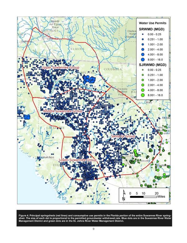
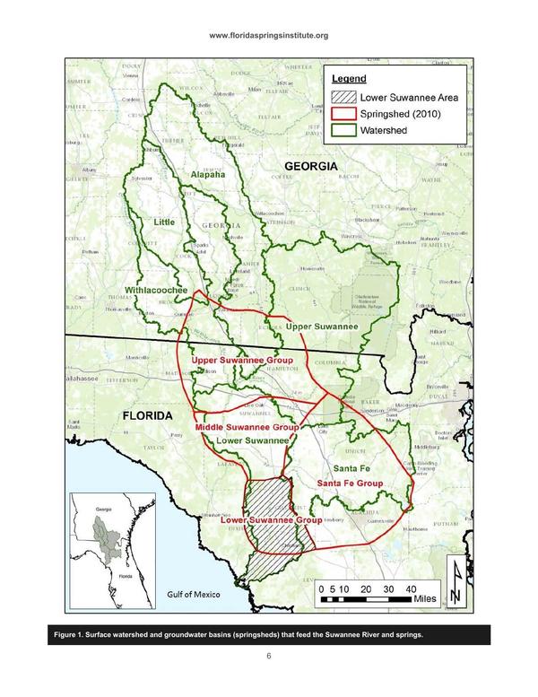
Thanks to Cody Suggs for pointing out that figure. That figure and the other below that shows springsheds vs. watersheds are both from A Plan to Restore the Lower Suwannee River Springs, Howard T. Odum Florida Springs Institute, January 2016, which is an executive summary of Lower Suwannee River Springs Restoration Plan, Prepared by The Howard T. Odum Florida Springs Institute, October 2015.
Fig. 1: Surface watershed and groundwater basins (springsheds) that feed the Suwannee River and springs.
-jsq, John S. Quarterman, Suwannee RIVERKEEPER®
You can join this fun and work by becoming a WWALS member today!
Short Link: