
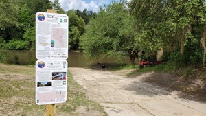
Access points on the WLRWT map
Last update: 2023-08-01
Suggest changes, additions, etc. in pictures or text through this form.
See also All points and Categories.
Summary Access Table
| WLRWT Miles |
Access Point | Ramp | Launch | Amenities | Miles to Next |
Paddle Time |
Latitude, Longitude | Low | High | Gauge† |
|---|---|---|---|---|---|---|---|---|---|---|
| Little River | ||||||||||
| 59.24 | Kinard Bridge Landing Cook Co., GA |
 |
6.19 | 3.1 | 31.2543, -83.507861 | 266.5 feet (-0.6′) | 271 feet (3.9′) | Tifton | ||
| 53.05 | Red Roberts Landing @ Rountree Bridge Road, Cook Co., GA |
|
  |
3.64 | 1.8 | 31.192222, -83.520333 | 266.5 feet (-0.6′) | 271 feet (3.9′) | Tifton | |
| 49.41 | Reed Bingham State Park West Boat Ramp Colquitt Co., GA |
 |
        |
0.33 | 0.2 | 31.16703, -83.54647 | ||||
| 49.08 | Reed Bingham State Park East Boat Ramp Cook Co., GA |
|
|
0.51 | 0.3 | 31.16253, -83.54123 | ||||
| 48.57 | Adel-Moultrie Landing @ GA 37, Colquitt Co., GA |
|
|
10.4 | 5.2 | 31.155313, -83.545061 | 175.3 feet (2.2′) | 181 feet (7.9′) | Adel | |
| 38.17 | Antioch Road Landing Cook Co., GA |
|
|
6.85 | 3.4 | 31.0682, -83.56425 | 175.3 feet (2.2′) | 181 feet (7.9′) | Adel | |
| 31.32 | Cook County Boat Ramp @ GA 76, Cook Co., GA |
|
|
6.02 | 3.0 | 31.040042, -83.493085 | 137 feet (4.2′) | 144 feet (11.2′) | Hahira | |
| 25.3 | Folsom Bridge Landing @ GA 122, Lowndes Co., GA |
|
|
24.94 | 12.5 | 31.000771, -83.456385 | 137 feet (4.2′) | 144 feet (11.2′) | Hahira | |
| 0.36 | Troupville Boat Ramp @ GA 133, Lowndes Co., GA |
|
|
11.07 | 5.5 | 30.851842, -83.346536 | 137 feet (4.2′) | 144 feet (11.2′) | Hahira | |
| Withlacoochee River | ||||||||||
| 97.63 | Youngs Mill Creek Landing @ GA 37, Cook Co., GA |
|
|
12.95 | 6.5 | 31.120974, -83.323322 | 122.6 feet (2.3′) | 131 feet (10.7′) | Skipper Bridge | |
| 84.68 | Hagan Bridge Landing @ GA 122, Lowndes Co., GA |
|
|
4.9 | 2.5 | 31.013966, -83.299306 | 122.6 feet (2.3′) | 131 feet (10.7′) | Skipper Bridge | |
| 79.78 | Franklinville Landing @ Franklinville Road, Lowndes Co., GA |
|
|
10.97 | 5.5 | 30.981249, -83.268027 | 122.6 feet (2.3′) | 131 feet (10.7′) | Skipper Bridge | |
| 68.81 | Langdale Park Boat Ramp Lowndes Co., GA |
|
|
3.14 | 1.6 | 30.88747, -83.32395 | 116 feet (5.7′) | 123 feet (12.7′) | Valdosta | |
| 65.67 | Sugar Creek Landing @ Gornto Road, Lowndes Co., GA |
|
|
13.91 | 7.0 | 30.85857, -83.3206 | 116 feet (5.7′) | 123 feet (12.7′) | Valdosta | |
| 51.76 | US 84 Landing Lowndes Co., GA |
|
8.51 | 4.3 | 30.793608, -83.451435 | 85.5 feet (2.0′) | 94 feet (10.5′) | Quitman | ||
| 43.25 | Knights Ferry Boat Ramp Lowndes Co., GA |
|
|
6.58 | 3.3 | 30.71205, -83.45554 | 85.5 feet (2.0′) | 94 feet (10.5′) | Quitman | |
| 36.67 | Clyattville-Nankin Boat Ramp Lowndes Co., GA |
|
|
8.88 | 4.4 | 30.675895, -83.393153 | 85.25 feet (1.8′) | 99 feet (15.5′) | Quitman | |
| 27.79 | State Line Boat Ramp @ GA 31, Lowndes Co., GA |
|
|
5.34 | 2.7 | 30.637844, -83.311149 | 85.25 feet (1.8′) | 99 feet (15.5′) | Quitman | |
| 22.45 | Sullivan Launch @ CR 150, Madison Co., FL |
|
|
8.81 | 4.4 | 30.595667, -83.26 | 52.5 feet (6.0′) | 61.5 feet (15.0′) | Pinetta | |
| 13.64 | Florida Campsites Ramp @ NW 47th St, Hamilton Co., FL |
|
|
1.67 | 0.8 | 30.501128, -83.242411 | 52.5 feet (6.0′) | 61.5 feet (15.0′) | Pinetta | |
| 11.97 | Madison Blue Spring State Park Launch @ FL-6, Madison Co., FL |
 |
|
1.99 | 1.0 | 30.480792, -83.244315 | 40.1 feet (0.1′) | 50 feet (10.0′) | Madison | |
| 9.98 | Madison Boat Ramp @ NE River Park Rd, Madison Co., FL |
|
|
1.73 | 0.9 | 30.465512, -83.223793 | 40.1 feet (0.1′) | 50 feet (10.0′) | Madison | |
| 8.25 | Allen Ramp @ SW 64th Way, Hamilton Co., FL |
|
|
11.37 | 5.7 | 30.449167, -83.221328 | 40.1 feet (0.1′) | 50 feet (10.0′) | Madison | |
| Suwannee River | ||||||||||
| 124.67 | Anderson Spring Launch Suwannee Co., FL |
|
0.0 | 30.352967, -83.18937 | Ellaville | |||||
† Advisory estimates for feet above sea level (NAVD88) on the indicated Gauge of:
Low: lowest boatable without a lot of dragging; at or slightly above NWS Low Stage
High: highest safe; at or slightly below NWS Action Stage
1 10, 000 gallons of raw sewage spilled 2020-08-17
2 contract for operation and maintenance by Lowndes County Utilties.
3 https://wwals.net/pictures/2021-07-08–sewage-spills-valdosta-starke
4 https://wwals.net/pictures/2021-07-08–sewage-spills-valdosta-starke
5 which is Williams Street between E. College and E. Moore Streets.
Distances between Access points
0.33 mile from Reed Bingham State Park West Boat Ramp to Reed Bingham State Park East Boat Ramp0.51 mile from Reed Bingham State Park East Boat Ramp to Adel-Moultrie Landing
1.67 miles from Florida Campsites Ramp to Madison Blue Spring State Park Launch
1.73 miles from Madison Boat Ramp to Allen Ramp
1.99 miles from Madison Blue Spring State Park Launch to Madison Boat Ramp
3.14 miles from Langdale Park Boat Ramp to Sugar Creek Landing
3.64 miles from Red Roberts Landing to Reed Bingham State Park West Boat Ramp
4.90 miles from Hagan Bridge Landing to Franklinville Landing
5.34 miles from State Line Boat Ramp to Sullivan Launch
6.02 miles from Cook County Boat Ramp to Folsom Bridge Landing
6.19 miles from Kinard Bridge Landing to Red Roberts Landing
6.58 miles from Knights Ferry Boat Ramp to Clyattville-Nankin Boat Ramp
6.85 miles from Antioch Road Landing to Cook County Boat Ramp
8.51 miles from US 84 Landing to Knights Ferry Boat Ramp
8.81 miles from Sullivan Launch to Florida Campsites Ramp
8.88 miles from Clyattville-Nankin Boat Ramp to State Line Boat Ramp
10.4 miles from Adel-Moultrie Landing to Antioch Road Landing
10.97 miles from Franklinville Landing to Langdale Park Boat Ramp
11.07 miles from Troupville Boat Ramp to US 84 Landing
11.37 miles from Allen Ramp to Anderson Spring Launch
12.95 miles from Youngs Mill Creek Landing to Hagan Bridge Landing
13.91 miles from Sugar Creek Landing to US 84 Landing
24.94 miles from Folsom Bridge Landing to Troupville Boat Ramp
Descriptions
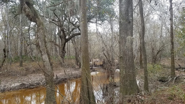
Kinard Bridge Landing
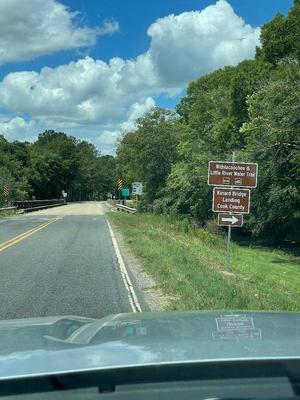
CATEGORIES: Landing
LAYER: Brochure
GPS: 31.2543, -83.507861
OWNERSHIP: Public
ACCESS: Yes, Launch: county road right of way
WATER BODY: Little River
Lowest boatable: 266.5′
Highest safe: 271′
GAUGE: Tifton
MILE: 59.24
ADDRESS: 2640 Kinard Bridge Rd, Lenox, GA 31637. North side of the road, left bank, east side of the river. From I-75 take exit 49, go west on Central Avenue, which becomes Kinard Bridge Road; it is three miles to the bridge. Cook County.
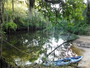
DESCRIPTION: This rough roadside access is the most upstream put-in on Little River in the Withlacoochee and Little River Water Trail. Downstream you may see Gum Creek, coming down almost sixty miles past Omega, or Warrior Creek coming down 73 miles past Sylvester. You might even spot Flat Ford. Mostly you will see cypress, tupelo, and pines, probably turtles, fish, and birds.
WEBSITE: https://wwals.net/pictures/2021-05-21–water-trail-signs-planted/
DOWNSTREAM: 6.19 miles from Kinard Bridge Landing to Red Roberts Landing
PHOTO: https://wwals.net/pictures/2021-05-21–water-trail-signs-planted/Kinard-Bridge-Road-Sign-East.jpg
PHOTOSET: https://wwals.net/pictures/2021-05-21–water-trail-signs-planted/
PHOTO SOURCE: Bobby McKenzie
PHONE NUMBER: (850) 290-2350
Suggestions: https://forms.gle/DipPgU2TP5atc2Rf9
Red Roberts Landing @ Rountree Bridge Road
CATEGORIES: Landing
LAYER: Brochure
OWNERSHIP: Public
ACCESS: Yes, Launch: dirt road to riverside, PARKING: Free, PICNIC AREA
WATER BODY: Little River
Lowest boatable: 266.5′
Highest safe: 271′
GAUGE: Tifton
MILE: 53.05
ADDRESS: 4727 Rountree Bridge Rd., Adel, GA 31620. River left at Rountree Bridge south of Rountree Bridge Road (CR 251) west of Adel; exit 41 off I-75. Cook County.
DESCRIPTION: The dirt entry road to this sloping riverside access has plenty of parking and woods trails. Put in here at the top of Reed Bingham State Park and paddle under cypress, tupelo, and pines on the winding blackwater Little River past three overlooks to the park Lake, where you will probably see alligators. Start point of the annual WWALS and FORB (Friends of Reed Bingham) BIG Little River Paddle Race.
WEBSITE: https://wwals.net/events-2/?ee=9
ADDITIONAL INFO SOURCES: https://wwals.net/2019/05/01/winners-big-little-river-paddle-race-2019-04-27/
UPSTREAM: 6.19 miles from Red Roberts Landing to Kinard Bridge Landing
DOWNSTREAM: 3.64 miles from Red Roberts Landing to Reed Bingham State Park West Boat Ramp
PHOTO: https://wwals.net/wp-content/themes/pianoblack/img//2015/05/9cd96f2addb1790f56bed88dffc8e65a.jpg
PHOTOSET: https://wwals.net/2015/05/18/winners-of-3rd-annual-big-little-river-paddle-race-2015-05-16/
PHOTO SOURCE: John S. Quarterman
PHONE NUMBER: (229) 242-0102
PHOTO2: https://www.wwals.net/pictures/2020-09-26–drafts-metal-signs/Red-Roberts-Landing-Sign-0001.jpg
Photoset2: https://www.wwals.net/pictures/2020-09-26–drafts-metal-signs/Red-Roberts-Landing-Sign-0001.html
PHOTO2 SOURCE: WWALS
Suggestions: https://forms.gle/DipPgU2TP5atc2Rf9

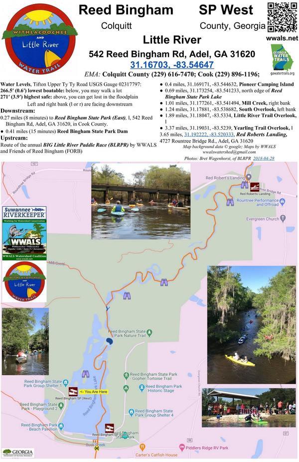
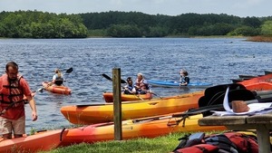
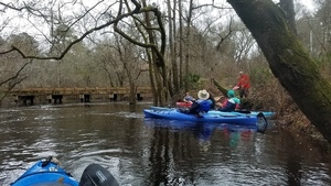
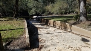
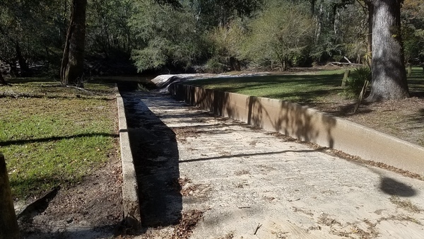
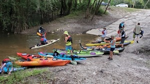
Reed Bingham State Park West Boat Ramp
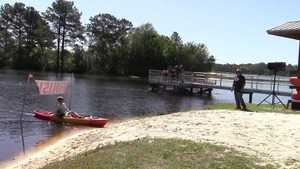
CATEGORIES: Landing
LAYER: Brochure
GPS: 31.16703, -83.54647
OWNERSHIP: Public
ACCESS: Yes, Ramp: Concrete, CANOE, CAMPING, FOOD: Snack Machine, WATER, Flush Toilet, PARKING: Park entrance fee, SHELTER, PICNIC AREA, HANDICAPPED ACCESSIBLE
WATER BODY: Little River
MILE: 49.41
ADDRESS: 542 Reed Bingham Rd, Adel, GA 31620. Take I-75 Exit 39, turn west on GA 37, right on Evergreen Church Road (CR 99), left on Reed Bingham SP Road (CR 221). Colquitt County.
DESCRIPTION: Paddle out on the 375-acre Reed Bingham State Park Lake to sightsee, fish for bass, crappie, catfish and bream, or camp on Pioneer Camping Island. Slightly downstream is the only dam on the Little River. The park rents boats and campsites. “”Nesting bald eagles are often seen in winter. American alligators are often seen sunning along the lake’s edge. During winter, thousands of black vultures and turkey vultures, roost in the trees and soar overhead.”
HISTORIC FACTS: Finish line for the annual WWALS and FORB (Friends of Reed Bingham State Park) BIG Little River Paddle Race.
AKA: Reed Bingham State Park (West) Boat Ramp
WEBSITE: https://georgiawildlife.com/locations/fishing
UPSTREAM: 3.64 miles from Reed Bingham State Park West Boat Ramp to Red Roberts Landing
DOWNSTREAM: 0.33 mile from Reed Bingham State Park West Boat Ramp to Reed Bingham State Park East Boat Ramp
PHOTO: https://wwals.net/pictures/gretchen/2019-04-27–wwals-blrpr/10-bib24-nikki-york.jpg
PHOTOSET: https://wwals.net/pictures/gretchen/2019-04-27–wwals-blrpr/
PHOTO SOURCE: Gretchen Quarterman
PHONE NUMBER: (850) 290-2350
PHOTO2: https://www.wwals.net/pictures/2020-09-26–drafts-metal-signs/Reed-Bingham-SP-West-Sign-0001.jpg
Photoset2: https://www.wwals.net/pictures/2020-09-26–drafts-metal-signs/Reed-Bingham-SP-West-Sign-0001.html
PHOTO2 SOURCE: WWALS
Suggestions: https://forms.gle/DipPgU2TP5atc2Rf9

Reed Bingham State Park East Boat Ramp
CATEGORIES: Landing
LAYER: Brochure
GPS: 31.16253, -83.54123
OWNERSHIP: Public
ACCESS: Yes, Ramp: Concrete, CANOE, CAMPING, FOOD: Snack Machine, WATER, Flush Toilet, PARKING: Park entrance fee, SHELTER, PICNIC AREA, HANDICAPPED ACCESSIBLE
WATER BODY: Little River
MILE: 49.08
ADDRESS: 542 Reed Bingham Rd, Adel, GA 31620. Take I-75 Exit 39, turn west on GA 37, right on Evergreen Church Road (CR 99), left on Reed Bingham SP Road (CR 221). Cook County.
DESCRIPTION: Paddle out on the 375-acre Reed Bingham State Park Lake for sightseeing or fish for bass, crappie, catfish and bream. Slightly downstream is the only dam on the Little River. The park rents boats and campsites. “”Nesting bald eagles are often seen in winter. American alligators are often seen sunning along the lake’s edge. During winter, thousands of black vultures and turkey vultures, roost in the trees and soar overhead.”
HISTORIC FACTS: Site of the Cook County Centennial in June 2019.
AKA: Reed Bingham State Park (East) Boat Ramp
WEBSITE: https://georgiawildlife.com/locations/fishing
ADDITIONAL INFO SOURCES: https://www.facebook.com/permalink.php?story_fbid=456792108483221&id=293673894795044
UPSTREAM: 0.33 mile from Reed Bingham State Park East Boat Ramp to Reed Bingham State Park West Boat Ramp
DOWNSTREAM: 0.51 mile from Reed Bingham State Park East Boat Ramp to Adel-Moultrie Landing
PHOTO: https://wwals.net/pictures/2019-06-22–reed-bingham-cook-county-centennial-forb/20190622_135502.jpg
PHOTOSET: https://wwals.net/pictures/2019-06-22–reed-bingham-cook-county-centennial-forb
PHOTO SOURCE: John S. Quarterman
PHONE NUMBER: (229) 242-0102
PHOTO2: https://www.wwals.net/pictures/2020-09-26–drafts-metal-signs/Reed-Bingham-SP-East-Sign-0001.jpg
Photoset2: https://www.wwals.net/pictures/2020-09-26–drafts-metal-signs/Reed-Bingham-SP-East-Sign-0001.html
PHOTO2 SOURCE: WWALS
Suggestions: https://forms.gle/DipPgU2TP5atc2Rf9

Adel-Moultrie Landing @ GA 37
CATEGORIES: Landing
LAYER: Brochure
OWNERSHIP: Public
ACCESS: Yes, Launch: dirt road to riverside, PARKING: Free
WATER BODY: Little River
Lowest boatable: 175.3′
Highest safe: 181′
GAUGE: Adel
MILE: 48.57
ADDRESS: 2 GA 37, Adel, GA 31620, Colquitt County.
DESCRIPTION: Easy access on the west (right bank, Colquitt County) side of Little River, south of GA 37, east of Moultrie towards Adel. This is the most upstream you can start a continuous paddle down the Little River (48.57 miles), then the Withlacoochee (another 62.47 miles), and Suwannee Rivers (127.79 miles), for about 239 river miles to the Gulf of Mexico. This is also one of the most remote and unspoiled stretches of river in the Withlacoochee and Little River Water Trail. Sand beaches abound for lunch or even overnight camping. In the new year expect yellow jessamine earliest, then wild native azaleas (Rhododendron canescens) blooming in their white to yellow or pink glory. In spring see red maple and white Grancy Greybeard and dogwood trees. In summer you may see the halberdleaf five-large-petaled swamp rose-mallow (Hibiscus laevis); each bloom only lasts one day. In the fall, expect swamp sunflower (Helianthus Angustifolius). Year-round, see loblolly pines, live oaks, water oaks, cypress, river birch, willow, and Spanish moss.
WEBSITE: https://wwals.net/pictures/2020-09-26–drafts-metal-signs/Adel-Moultrie-Landing-Sign-0001.html
ADDITIONAL INFO SOURCES: https://wwals.net/2018/04/10/canoeing-from-the-little-to-the-chee-by-burt-kornegay-2018-03-24/
UPSTREAM: 0.51 mile from Adel-Moultrie Landing to Reed Bingham State Park East Boat Ramp
DOWNSTREAM: 10.4 miles from Adel-Moultrie Landing to Antioch Road Landing
PHOTO: https://wwals.net/pictures/2021-05-21–water-trail-signs-planted/Adel-Moultrie-sign.jpg
PHOTOSET: https://wwals.net/pictures/2021-05-21–water-trail-signs-planted/
PHOTO SOURCE: Bobby McKenzie
PHONE NUMBER: (850) 290-2350
PHOTO2: https://wwals.net/pictures/2020-09-26–drafts-metal-signs/Adel-Moultrie-Landing-Sign-0001.jpg
Photoset2: https://wwals.net/pictures/2020-09-26–drafts-metal-signs/Adel-Moultrie-Landing-Sign-0001.html
PHOTO2 SOURCE: WWALS
Photo2 Phone Number: 850-290-2350
Suggestions: https://forms.gle/DipPgU2TP5atc2Rf9

Antioch Road Landing
CATEGORIES: Landing
LAYER: Brochure
GPS: 31.0682, -83.56425
OWNERSHIP: Public
ACCESS: Yes, Launch: river bank down rough county road right of way. PARKING: Free
WATER BODY: Little River
Lowest boatable: 175.3′
Highest safe: 181′
GAUGE: Adel
MILE: 38.17
ADDRESS: Southwest of Adel, SE side of Antioch Road, NE side of Little River, left bank, under the power line. Cook County.
DESCRIPTION: Year-round, see loblolly pines, live oaks, water oaks, cypress, river birch, willow, and Spanish moss. Sand beaches abound for lunch or even overnight camping. In the new year expect yellow jessamine earliest, then wild native azaleas (Rhododendron canescens), white to yellow or pink glory. In spring see red maple and white Grancy Greybeard and dogwood trees. In summer you may see the halberdleaf five-large-petaled swamp rose-mallow (Hibiscus laevis); each bloom only lasts one day. In the fall, expect swamp sunflower (Helianthus Angustifolius).
WEBSITE: https://wwals.net/pictures/2020-09-26–drafts-metal-signs/Antioch-Road-Landing-Sign-0001.html
ADDITIONAL INFO SOURCES: https://wwals.net/2018/04/10/canoeing-from-the-little-to-the-chee-by-burt-kornegay-2018-03-24/
UPSTREAM: 10.4 miles from Antioch Road Landing to Adel-Moultrie Landing
DOWNSTREAM: 6.85 miles from Antioch Road Landing to Cook County Boat Ramp
PHOTOSET: https://wwals.net/pictures/2021-05-21–water-trail-signs-planted/
PHOTO SOURCE: Bobby McKenzie
PHONE NUMBER: (850) 290-2350
PHOTO2: https://wwals.net/pictures/2020-09-26–drafts-metal-signs/Antioch-Road-Landing-Sign-0001.jpg
Photoset2: https://wwals.net/pictures/2020-09-26–drafts-metal-signs/Antioch-Road-Landing-Sign-0001.html
PHOTO2 SOURCE: WWALS
Photo2 Phone Number: 850-290-2350
Suggestions: https://forms.gle/DipPgU2TP5atc2Rf9

Cook County Boat Ramp @ GA 76
CATEGORIES: Landing
LAYER: Brochure
OWNERSHIP: Public
ACCESS: Yes, Ramp: dirt and gravel access road to concrete ramp, PARKING: Free
WATER BODY: Little River
Lowest boatable: 137
Highest safe: 144
GAUGE: Hahira
MILE: 31.32
ADDRESS: 966 Quitman Highway (GA 76), Adel, GA 31620, Cook County.
DESCRIPTION: Left bank, southeast of the road. Upstream of this GA-DNR boat ramp, Stone Bridge is the star of the Little River. Downstream is a nice paddle with many fish in deep holes of the shallow river, after some popular picnic sandbars. Cook County Boat Ramp is loacted between Adel and Barney, southeast side of GA 76, northeast side (left bank) of the Little River.
AKA: Cook County Landing (GDOT)
WEBSITE: https://www.georgiaoutdoormap.com/
ADDITIONAL INFO SOURCES: https://www.theswimguide.org/beach/9697
UPSTREAM: 6.85 miles from Cook County Boat Ramp to Antioch Road Landing
DOWNSTREAM: 6.02 miles from Cook County Boat Ramp to Folsom Bridge Landing
PHOTO: https://wwals.net/pictures/2020-05-16–stone-bridge-paddle/20200516_100818.jpg
PHOTOSET: https://wwals.net/pictures/2020-05-16–stone-bridge-paddle/
PHOTO SOURCE: John S. Quarterman
PHONE NUMBER: (229) 242-0102
PHOTO2: https://wwals.net/pictures/2020-09-26–drafts-metal-signs/Cook-County-Boat-Ramp-Sign-0001.jpg
Photoset2: https://wwals.net/pictures/2020-09-26–drafts-metal-signs/Cook-County-Boat-Ramp-Sign-0001.html
PHOTO2 SOURCE: WWALS
Photo2 Phone Number: 850-290-235
Suggestions: https://forms.gle/DipPgU2TP5atc2Rf9

Folsom Bridge Landing @ GA 122
CATEGORIES: Landing
LAYER: Brochure
OWNERSHIP: Public
ACCESS: Yes, Launch: dirt road to riverside, PARKING: Free
WATER BODY: Little River
Lowest boatable: 137
Highest safe: 144
GAUGE: Hahira
MILE: 25.30
ADDRESS: 8630 GA Hwy 122 W, Hahira, GA 31632. Lowndes County.
DESCRIPTION: Left bank. This sand riverbank begins by far the longest stretch of the WLRWT, and one of the wildest, with plenty of swamps and oxbows to get lost in cypress, pines, tupelo, red maples, and river birch. Between Hahira and Barney, north side of GA 122 turn onto Wells Road, immediate left to the east side of river, Usually lots of mussels. Fish jump in the spring, and bed in pools in this idyllic blackwater south Georgia River. For those from elsewhere: fish make beds for laying their eggs. The beds appear as round and slightly concave areas cleared in the sand, about a foot in diameter.
AKA: GA 122 Little River Access.
WEBSITE: https://wwals.net/2016/09/26/little-river-scouting-2016-07-10/
ADDITIONAL INFO SOURCES: https://www.theswimguide.org/beach/9698
UPSTREAM: 6.02 miles from Folsom Bridge Landing to Cook County Boat Ramp
DOWNSTREAM: 24.94 miles from Folsom Bridge Landing to Troupville Boat Ramp
PHOTO: https://wwals.net/pictures/2021-05-21–water-trail-signs-planted/Folsom-Bridge.jpg
PHOTOSET: https://wwals.net/pictures/2021-05-21–water-trail-signs-planted/
PHOTO SOURCE: Bobby McKenzie
PHONE NUMBER: (850) 290-2350
PHOTO2: https://wwals.net/pictures/2020-09-26–drafts-metal-signs/Folsom-Bridge-Landing-Sign-0001.jpg
Photoset2: https://wwals.net/pictures/2020-09-26–drafts-metal-signs/Folsom-Bridge-Landing-Sign-0001.html
PHOTO2 SOURCE: WWALS
Photo2 Phone Number: 850-290-2350
Suggestions: https://forms.gle/DipPgU2TP5atc2Rf9

Troupville Boat Ramp @ GA 133
CATEGORIES: Landing
LAYER: Brochure
OWNERSHIP: Public, VLPRA, PARCEL 0057 002A
ACCESS: Yes, Ramp: Concrete on dirt access road, PARKING: Free, PICNIC AREA, HANDICAPPED ACCESSIBLE
WATER BODY: Little River
Lowest boatable: 137
Highest safe: 144
GAUGE: Hahira
MILE: 0.36
ADDRESS: 19664 Valdosta Hwy, Valdosta, GA 31602. I-75 exit 18, west on GA 133 (St. Augustine Road) away from the Valdosta Mall, at the traffic light for Val Tech Road, turn left down to the boat ramp. Lowndes County.
DESCRIPTION: This GA-DNR boat ramp on the left bank of the Little River is in a 49-acre local park, just west of the most populous city in the Suwannee River Basin. It is the last access to the Little River and often the first access to the Withlacoochee River, which is only a couple thousand feet downstream. It’s about 11 river miles downstream past the Little River Confluence and the clean treated water outfall of the Valdosta Withlacoochee Wastewater Treatment Plant to US 84 Landing, which is the roughest takeout on the WLRWT. Troupville Boat Ramp is also a good takeout after 6.72 Withlacoochee River miles downstream from Langdale Park Boat Ramp. Remember to turn right at the Little River Confluence to paddle those last couple thousand feet upstream. This is a Georgia Department of Natural Resources (DNR) boat ramp operated by Valdosta-Lowndes County Parks and Recreation Authority, in a 49.36-acre park. Local elected officials are raising funds to buy the 74 acres from there down to the Little River Confluence, to make a combined 123-acre park and to build the Troupville River Camp proposed by WWALS, here at the center of the Withlacoochee and Little River Water Trail. https://wwals.net/2019/11/05/troupville-river-camp-center-of-little-and-withlacoochee-river-water-trail-2019-10-31/
HISTORIC FACTS: Lowndes County bought the adjoining 71 acres down to the Little River Confluence from Helen Tapp on December 13, 2022, to add to the 49 VLPRA acres as a public park. https://wwals.net/?p=60481 Start of Paddle Georgia 2019. Troupville was the former county seat of Lowndes County, Georgia, here between the blackwater Little and Withlacoochee Rivers. In 1860 the entire town picked up and moved four miles east to the path of the first railroad, and renamed itself Valdosta.
AKA: Little River Boat Ramp (old VLPRA name), Troupville Landing (after the name of the old Lowndes County seat), Troupeville Landing (GDOT), the prison boat ramp (after the state prison across the road).
WEBSITE: http://vlpra.com/231/Troupville-Boat-Ramp
OTHER REFERENCE: https://wwals.net/2018/03/16/ockolocoochee-little-river-1889-01-29/
ADDITIONAL INFO SOURCES: https://wwals.net/pictures/2019-06-15–troupville-confluence-spook-bridge/ https://www.theswimguide.org/beach/9699
UPSTREAM: 24.94 miles from Troupville Boat Ramp to Folsom Bridge Landing
DOWNSTREAM: 11.07 miles from Troupville Boat Ramp to US 84 Landing
PHOTO: https://wwals.net/pictures/2019-06-15–troupville-confluence-spook-bridge/20190615_075154.jpg
PHOTOSET: https://wwals.net/pictures/2019-06-15–troupville-confluence-spook-bridge/
PHOTO SOURCE: John S. Quarterman
PHONE NUMBER: (229) 242-0102
PHOTO2: https://wwals.net/pictures/2020-09-26–drafts-metal-signs/Troupville-Boat-Ramp-Sign-0001.jpg
Photoset2: https://wwals.net/pictures/2020-09-26–drafts-metal-signs/Troupville-Boat-Ramp-Sign-0001.html
PHOTO2 SOURCE: WWALS
Photo2 Phone Number: 850-290-2350
Suggestions: https://forms.gle/DipPgU2TP5atc2Rf9

Youngs Mill Creek Landing @ GA 37
CATEGORIES: Landing
LAYER: Brochure
OWNERSHIP: Public
ACCESS: Yes, Launch: paved asphalt access road to sand riverbank, PARKING: Free
WATER BODY: Withlacoochee River
Lowest boatable: 122.6′
Highest safe: 131′
GAUGE: Skipper Bridge
MILE: 97.63
ADDRESS: Right bank, 13766 Highway 37, Adel, GA 31620, Cook County.
DESCRIPTION: East of Adel towards Ray City, GA, a paved access ramp leads almost to the riverside. Expect to get lost in the swamps at least once, and to have to portage over deadfalls. So be prepared to camp at least one night, while owls sing you to sleep and crows wake you up in the morning. In the new year expect yellow jessamine earliest, then wild native azaleas (Rhododendron canescens) blooming in their white to yellow or pink glory. In spring see red maple and white Grancy Greybeard and dogwood trees. In summer you may see the halberdleaf five-large-petaled swamp rose-mallow (Hibiscus laevis). Year-round, see loblolly pines, live oaks, water oaks, cypress, river birch, willow, and Spanish moss.
AKA: Youngs MIll Landing.
WEBSITE: https://wwals.net/pictures/2018-02-18–ga-37-withlacoochee/#YMCL
DOWNSTREAM: 12.95 miles from Youngs Mill Creek Landing to Hagan Bridge Landing
PHOTO: https://wwals.net/pictures/2018-02-18–ga-37-withlacoochee/20180218_075754.jpg
PHOTOSET: https://wwals.net/pictures/2018-02-18–ga-37-withlacoochee/
PHOTO SOURCE: John S. Quarterman
PHONE NUMBER: (229) 242-0102
PHOTO2: https://wwals.net/pictures/2020-09-26–drafts-metal-signs/Youngs-Mill-Creek-Landing-Sign-0001.jpg
Photoset2: https://wwals.net/pictures/2020-09-26–drafts-metal-signs/Youngs-Mill-Creek-Landing-Sign-0001.html
PHOTO2 SOURCE: WWALS
Photo2 Phone Number: 850-290-2350
Suggestions: https://forms.gle/DipPgU2TP5atc2Rf9

Hagan Bridge Landing @ GA 122
CATEGORIES: Landing
LAYER: Brochure
OWNERSHIP: Public
ACCESS: Yes, Launch: dirt access road to sand riverbank, PARKING: Free
WATER BODY: Withlacoochee River
Lowest boatable: 122.6′
Highest safe: 131′
GAUGE: Skipper Bridge
MILE: 84.68
ADDRESS: 5110 GA Hwy 122 E, Hahira, GA 31632, Lowndes County.
DESCRIPTION: This short stretch can take longer than you expect, if you take the Franklinville Roundabout more than once, or if you get lost in the woods, or if there are many deadfalls. In the new year expect blooming yellow jessamine, then wild native azaleas (Rhododendron canescens). In spring see red maple and white Grancy Greybeard and dogwood trees. Year-round, see resurrection fern, palmettos, pines, live and water oaks, cypress, tiver Bitch, willows and Spanish moss. Upstream: long, twisty, deadfalls, no takeouts for 13 miles. 5 miles east of Hahira, GA. Between Hahira and Lakeland.
AKA: GA 122 Withlacoochee Access.
WEBSITE: https://wwals.net/pictures/2018-02-11–hagan-bridge-franklinville/#Hagan-Bridge
ADDITIONAL INFO SOURCES: https://www.theswimguide.org/beachmanager/beaches/view?id=10197
UPSTREAM: 12.95 miles from Hagan Bridge Landing to Youngs Mill Creek Landing
DOWNSTREAM: 4.90 miles from Hagan Bridge Landing to Franklinville Landing
PHOTO: https://wwals.net/pictures/2018-02-11–hagan-bridge-franklinville/20180211_100603.jpg
PHOTOSET: https://wwals.net/pictures/2018-02-11–hagan-bridge-franklinville/
PHOTO SOURCE: John S. Quarterman
PHONE NUMBER: (229) 242-0102
PHOTO2: https://wwals.net/pictures/2020-09-26–drafts-metal-signs/Hagan-Bridge-Landing-Sign-0001.jpg
Photoset2: https://wwals.net/pictures/2020-09-26–drafts-metal-signs/Hagan-Bridge-Landing-Sign-0001.html
PHOTO2 SOURCE: WWALS
Photo2 Phone Number: 850-290-2350
Suggestions: https://forms.gle/DipPgU2TP5atc2Rf9

Franklinville Landing @ Franklinville Road
CATEGORIES: Landing
LAYER: Brochure
OWNERSHIP: Public
ACCESS: Yes, Launch: Riverside bank on dirt road, PARKING: Free
WATER BODY: Withlacoochee River
Lowest boatable: 122.6′
Highest safe: 131′
GAUGE: Skipper Bridge
MILE: 79.78
ADDRESS: 6560 Franklinville Road, Hahira, GA 31632. Lowndes County.
DESCRIPTION: Downstream it’s 11 miles to Langdale Park Boat Ramp. If there are no deadfalls, it should be no problem. In the new year expect blooming yellow jessamine, then wild native azaleas (Rhododendron canescens). In spring see red maple and white Grancy Greybeard and dogwood trees. Year-round, see resurrection fern, palmettos, pines, live and water oaks, cypress, tiver Bitch, willows and Spanish moss. Upstream it’s a little less than five miles to Hagan Bridge Landing, but there likely will be deadfalls, and beware of the Franklinville Roundabout, which can lead you in circles. Between Hahira and Moody AFB on Franklinville Road. Must enter from the west from Skipper Bridge Road.
HISTORIC FACTS: Tyler Bridge closed about in the 1990s per request of local landowners, so Franklinville Road now acts as a barrier to northward sprawl of subdivision development.
WEBSITE: https://wwals.net/pictures/2018-02-11–hagan-bridge-franklinville/
UPSTREAM: 4.90 miles from Franklinville Landing to Hagan Bridge Landing
DOWNSTREAM: 10.97 miles from Franklinville Landing to Langdale Park Boat Ramp
PHOTO: https://wwals.net/pictures/2018-02-11–hagan-bridge-franklinville/20180211_132521.jpg
PHOTOSET: https://wwals.net/pictures/2018-02-11–hagan-bridge-franklinville/
PHOTO SOURCE: John S. Quarterman
PHONE NUMBER: (229) 242-0102
PHOTO2: https://wwals.net/pictures/2020-09-26–drafts-metal-signs/Franklinville-Landing-Sign-0001.jpg
Photoset2: https://wwals.net/pictures/2020-09-26–drafts-metal-signs/Franklinville-Landing-Sign-0001.html
PHOTO2 SOURCE: WWALS
Photo2 Phone Number: 850-290-2350
Suggestions: https://forms.gle/DipPgU2TP5atc2Rf9

Langdale Park Boat Ramp
CATEGORIES: Landing
LAYER: Brochure
GPS: 30.88747, -83.32395
OWNERSHIP: Public, VLPRA
ACCESS: Yes, Ramp: Concrete at end of long dirt access road, PARKING: Free, SHELTER: For rent by VLPRA, PICNIC AREA
WATER BODY: Withlacoochee River
Lowest boatable: 116′
Highest safe: 123′
GAUGE: Valdosta
MILE: 68.81
ADDRESS: 3781 N. Valdosta Rd., Valdosta, GA 31602, Lowndes County.
DESCRIPTION: Left bank. Except for the highways, a railroad, and downstream trash heaps on logjams, mostly you wouldn’t know you’re paddling next to the most populous city in the Suwannee River Basin, starting at this Valdosta-Lowndes County Parks & Rec. (VLPRA) Park. Earliest, expect yellow jessamine, then wild native azaleas (Rhododendron canescens). In spring, see red maple and white Grancy Greybeard and dogwood. Year-round, see loblolly pines, live oaks, water oaks, cypress, river birch, willow, and Spanish moss.
WEBSITE: http://vlpra.com/217/Langdale-Park
ADDITIONAL INFO SOURCES: https://www.theswimguide.org/beach/9934
UPSTREAM: 10.97 miles from Langdale Park Boat Ramp to Franklinville Landing
DOWNSTREAM: 3.14 miles from Langdale Park Boat Ramp to Sugar Creek Landing
PHOTO: https://wwals.net/wp-content/themes/pianoblack/img//2017/11/601cc8cde870315dc238ff6d8dd009da.jpg
PHOTOSET: https://wwals.net/2017/11/24/langdale-park-open-2017-11-01/
PHOTO SOURCE: John S. Quarterman
PHONE NUMBER: (229) 242-0102
PHOTO2: https://wwals.net/pictures/2020-09-26–drafts-metal-signs/Langdale-Park-Boat-Ramp-Sign-0001.jpg
Photoset2: https://wwals.net/pictures/2020-09-26–drafts-metal-signs/
PHOTO2 SOURCE: WWALS
Photo2 Phone Number: 850-290-2350
Suggestions: https://forms.gle/DipPgU2TP5atc2Rf9

Sugar Creek Landing @ Gornto Road
CATEGORIES: Landing
LAYER: Brochure
GPS: 30.85857, -83.3206
OWNERSHIP: Public, Lowndes County
ACCESS: Yes, Launch: long walk through floodplain to riverbank. PARKING: YMCA parking lot.
WATER BODY: Withlacoochee River
Lowest boatable: 116′
Highest safe: 123′
GAUGE: Valdosta
MILE: 65.67
ADDRESS: 2410 Gornto Rd., Valdosta, GA 31602, Lowndes County.
DESCRIPTION: Sliver of public land just left of Valdosta sewage pump station.
AKA: Gornto Road Landing.
WEBSITE: https://wwals.net/2018/01/29/gornto-road-valdosta-access-to-withlacoochee-river-2018-01-24/
UPSTREAM: 3.14 miles from Sugar Creek Landing to Langdale Park Boat Ramp
DOWNSTREAM: 13.91 miles from Sugar Creek Landing to US 84 Landing
PHOTO: https://wwals.net/wp-content/themes/pianoblack/img//2018/01/3ae32268ea80c1ef013bb208e2daa277.jpg
PHOTOSET: https://wwals.net/2018/01/29/gornto-road-valdosta-access-to-withlacoochee-river-2018-01-24/
PHOTO SOURCE: John S. Quarterman
PHONE NUMBER: (229) 242-0102
Suggestions: https://forms.gle/DipPgU2TP5atc2Rf9
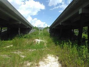
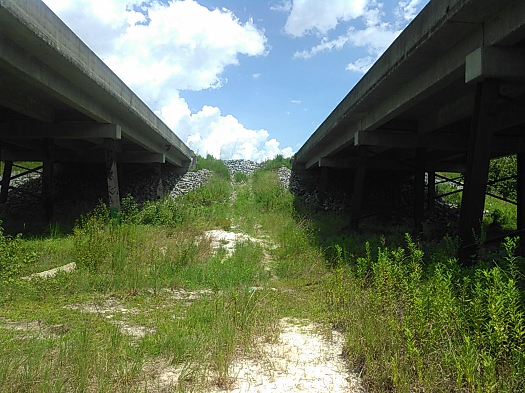
US 84 Landing
CATEGORIES: Landing
LAYER: Brochure
OWNERSHIP: Public
ACCESS: Yes, Launch: wooded riverbank reached from between twin state highway bridges.
WATER BODY: Withlacoochee River
Lowest boatable: 85.5′
Highest safe: 94′
GAUGE: Quitman
MILE: 51.76
ADDRESS: 5092 US 84 W, Valdosta, GA 31601, Lowndes County.
DESCRIPTION: Between the twin highway bridges on the Lowndes County side, scramble down and stay to the right for this problematical access to the subtropical blackwater Withlacoochee River. No ramp, no launch, plenty of catbriars, blackberry thorns, skeeters, and chiggers; ticks, too, if you’re lucky. Park in the median between the two bridges. Better: shuttle your vehicle on down to the takeout.
AKA: Quitman Landing.
ADDITIONAL INFO SOURCES: https://www.theswimguide.org/beach/9589
UPSTREAM: 13.91 miles from US 84 Landing to Sugar Creek Landing
DOWNSTREAM: 8.51 miles from US 84 Landing to Knights Ferry Boat Ramp
PHOTO: https://wwals.net/wp-content/themes/pianoblack/img//2015/08/db3ecb1f3bcd2a77fe0bd5f186544f5e.jpg
PHOTOSET: https://wwals.net/2015/08/21/withlacoochee-river-at-us-84/
PHOTO SOURCE: John S. Quarterman
PHONE NUMBER: (229) 242-0102
PHOTO2: https://wwals.net/wp-content/themes/pianoblack/img//2015/08/fdb8d58502f0f717b3a7c6aff38bdb0d.jpg
Photoset2: https://wwals.net/2015/08/21/withlacoochee-river-at-us-84/
PHOTO2 SOURCE: John S. Quarterman
Photo2 Phone Number: 229-242-0102
Suggestions: https://forms.gle/DipPgU2TP5atc2Rf9
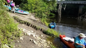
Knights Ferry Boat Ramp
CATEGORIES: Landing
LAYER: Brochure
GPS: 30.71205, -83.45554
OWNERSHIP: Public, VLPRA
ACCESS: Yes, Ramp: Concrete in a 2-acre park at the end of a dirt county road. PARKING: Free, PICNIC AREA
WATER BODY: Withlacoochee River
Lowest boatable: 85.5′
Highest safe: 94′
GAUGE: Quitman
MILE: 43.25
ADDRESS: 6499 Knights Ferry Rd, Valdosta, GA 31601, Lowndes County.
DESCRIPTION: At the end of a dirt road in the woods, this bucolic boat ramp is a great place to put in for a 6.65-mile paddle downstream on the subtropical blackwater Withlacoochee River, past cypress knees, tupelo trees, and wild azaleas in the spring. Alligators are not often seen here, but turtles are common. You might see a great blue heron. Paddle time will vary from about 3.5 hours if the water level is good, to dragging the boat if it’s too low (2.0′ or 85.5′ NAVD88), to very fast if it’s high (highest safe 10.5′ or 94′ NAVD88), or on the Quitman USGS gauge at US 84. If the parking lot is flooded, come back another day.
WEBSITE: http://vlpra.com/230/Knights-Ferry-Boat-Ramp
ADDITIONAL INFO SOURCES: https://www.theswimguide.org/beach/9586
UPSTREAM: 8.51 miles from Knights Ferry Boat Ramp to US 84 Landing
DOWNSTREAM: 6.58 miles from Knights Ferry Boat Ramp to Clyattville-Nankin Boat Ramp
PHOTO: https://wwals.net/pictures/2019-06-16–paddle-ga-day-2/20190616_104932.jpg
PHOTOSET: https://wwals.net/pictures/2019-06-16–paddle-ga-day-2/20190616_104932.html
PHOTO SOURCE: John S. Quarterman
PHONE NUMBER: (229) 242-0102
PHOTO2: https://wwals.net/pictures/2020-09-26–drafts-metal-signs/Knights-Ferry-Boat-Ramp-Sign-0001.jpg
Photoset2: https://wwals.net/pictures/2020-09-26–drafts-metal-signs/Knights-Ferry-Boat-Ramp-Sign-0001.html
PHOTO2 SOURCE: WWALS
Photo2 Phone Number: 850-290-2350
Suggestions: https://forms.gle/DipPgU2TP5atc2Rf9

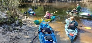
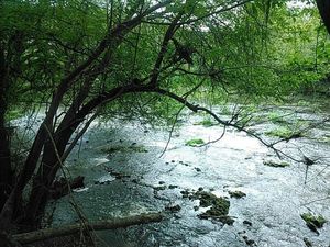
Clyattville-Nankin Boat Ramp
CATEGORIES: Landing
LAYER: Brochure
OWNERSHIP: Public, VALDOSTA LOWNDES COUNTY PARKS & RECREATION AUTHORITY, PARCEL 0042 001
ACCESS: Yes, Ramp: Concrete in 1-acre park with asphalt on first steep slope down from the main road. PARKING: Free, PICNIC AREA
WATER BODY: Withlacoochee River
Lowest boatable: 85.25′
Highest safe: 99′
GAUGE: Quitman
MILE: 36.67
ADDRESS: 6899 Clyattville-Nankin Road, Valdosta, GA 31601, Lowndes County.
DESCRIPTION: Good put-in for an 8.9-mile paddle downstream past springs and rapids to the GA-FL state line on the subtropical blackwater Withlacoochee River. Don’t miss McIntyre Spring, on the right, about halfway down. It’s one of only six second-magnitude springs in Georgia, and another is farther along: Arnold Springs. You may see an otter; you will very likely see turtles and many fish. In the summer you may see the swamp rosemallow that blooms only one day per bloom in June. In the spring you will see red maple and wild azalea. Buzzards will follow you, but don’t worry: the alligators are more scared of you. Paddle times will vary from nope when the parking lot is flooded, very fast (4 miles per hour) if the water is near the highest safe on the Quitman (US 84) gauge, or dragging the boat if it’s below the low water recommendation.
AKA: Nankin Boat Ramp or Clyattville-Nankin Landing
WEBSITE: http://vlpra.com/232/Nankin-Boat-Ramp
OTHER REFERENCE: https://wwals.net/2021/08/08/four-miles-an-hour-nankin-to-sullivan-withlacoochee-river-2021-08-07/
ADDITIONAL INFO SOURCES: https://www.theswimguide.org/beach/9587
UPSTREAM: 6.58 miles from Clyattville-Nankin Boat Ramp to Knights Ferry Boat Ramp
DOWNSTREAM: 8.88 miles from Clyattville-Nankin Boat Ramp to State Line Boat Ramp
PHOTO: https://wwals.net/pictures/2019-06-16–paddle-ga-day-2/20190616_110937.jpg
PHOTOSET: https://wwals.net/pictures/2019-06-16–paddle-ga-day-2/
PHOTO SOURCE: John S. Quarterman
PHONE NUMBER: (229) 242-0102
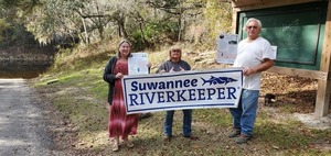
PHOTO2: https://www.wwals.net/pictures/2023-06-08–wq-sampling/20230608_131610.jpg
Photoset2: https://www.wwals.net/pictures/2023-06-08–wq-sampling/
PHOTO2 SOURCE: WWALS
Photo2 Phone Number: 850-290-2350
Suggestions: https://forms.gle/DipPgU2TP5atc2Rf9

State Line Boat Ramp @ GA 31
CATEGORIES: Landing
LAYER: Brochure
OWNERSHIP: Public, VLPRA
ACCESS: Yes, Ramp: Concrete on paved entrance driveway. PARKING: Free, PICNIC AREA
WATER BODY: Withlacoochee River
Lowest boatable: 85.25′
Highest safe: 99′
GAUGE: Quitman
MILE: 27.79
ADDRESS: 6461 Madison Hwy, Valdosta, GA 31601 near the Georgia-Florida State Line. Lowndes County.
DESCRIPTION: Down this GA-DNR boat ramp, just past those old bridge posts and around that bend, is the state line, on the blackwater Withlacoochee River. Site of the annual autumn WWALS Boomerang paddle race, from Georgia into Florida and back again. There’s almost always enough water, more than 1.8′ or 85.25′ NAVD88 on the Quitman (US 84) gauge. Best to avoid above 10.5′ or 94′ NAVD88. From Pinetta, Madison County, FL, travel north on CR 145; cross the Withlacoochee River; at the end of the bridge turn left and follow road to ramp in Hamilton County, FL. From Georgia, take I-75 south to Exit 11. Turn right onto Madison Highway. Go 8.7 miles. Turn right at the boat ramp sign.
HISTORIC FACTS: Mozell Spell had a restaurant called Mozell’s Catfish and Spell’s Seafood, usually called Mozell Spell’s. https://wwals.net/2019/06/17/at-the-ga-fl-line-2019-06-17/ The name stuck for the river access, although the apostrophe is usually omitted. Mozell Spell is buried in Sunset Hill Cemetery in Valdosta.
AKA: Mozell Spells (local people) or Madison Highway Boat Ramp (VLPRA) or State Line Ramp (GA DNR) or GA 31 Ramp (SRWMD) or CR 145 Bridge Launch (FDEP).
WEBSITE: http://vlpra.com/233/Madison-Highway-Boat-Ramp
OTHER REFERENCE: https://wwals.net/pictures/2020-09-26–drafts-metal-signs/State-Line-Boat-Ramp-Sign-0001.html
ADDITIONAL INFO SOURCES: https://www.theswimguide.org/beach/9588
UPSTREAM: 8.88 miles from State Line Boat Ramp to Clyattville-Nankin Boat Ramp
DOWNSTREAM: 5.34 miles from State Line Boat Ramp to Sullivan Launch
PHOTO: https://wwals.net/pictures/2018-11-03–wwals-boomerang-pictures/20181103_105635.jpg
PHOTOSET: https://wwals.net/pictures/2020-10-24–boomerang-front-videos/final-finishers.html
PHOTO SOURCE: John S. Quarterman
PHONE NUMBER: (229) 242-0102
PHOTO2 SOURCE: WWALS
Photo2 Phone Number: 850-290-2350
Suggestions: https://forms.gle/DipPgU2TP5atc2Rf9

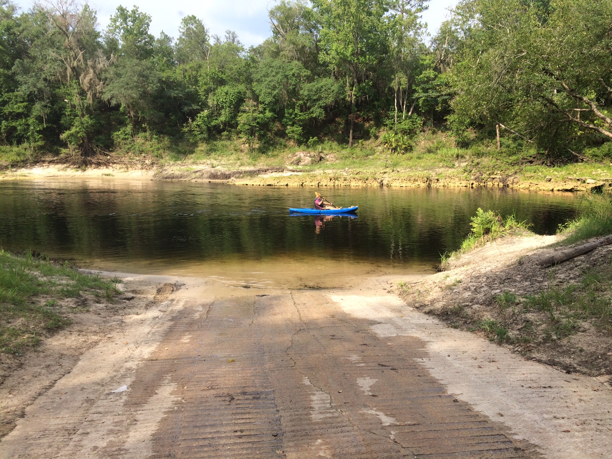
Sullivan Launch @ CR 150
CATEGORIES: Landing
LAYER: Brochure
GPS: 30.595667, -83.26
OWNERSHIP: Public, SRWMD
ACCESS: Yes, Launch: Concrete, PARKING: Free, PICNIC AREA
WATER BODY: Withlacoochee River
Lowest boatable: 52.5′
Highest safe: 61.5
GAUGE: Pinetta
MILE: 22.45
ADDRESS: From CR 150 (NE Bellville Road) east of Pinetta, south of the road, downstream of river bridge, right (west) bank. Madison County.
DESCRIPTION: The first public access point in Florida to the blackwater Withlacoochee River, Sullivan launch is a narrow concrete launch with free parking and a picnic area, but no picnic tables. It is in the Sullivan Tract of Twin Rivers State Park. From Pinetta, Madison County, FL, travel east on CR 150; turn right at the bridge and follow road to the launch south of the river bridge. Downstream it’s 8.8 miles or about 4.4 miles to paddle to Florida Campsites Ramp. First thing you’ll see is the twisted remains of the old Bellville Bridge, and on the right bank the Pinetta gauge.
AKA: CR 150 Bridge Launch (FDEP).
GRN: Yes
WEBSITE: https://www.mysuwanneeriver.com/documentcenter/home/view/31
OTHER REFERENCE: https://www.fdacs.gov/Forest-Wildfire/Our-Forests/State-Forests/Twin-Rivers-State-Forest/Recreation-at-Twin-Rivers-State-Forest#sullivan
ADDITIONAL INFO SOURCES: https://www.theswimguide.org/beach/9632
UPSTREAM: 5.34 miles from Sullivan Launch to State Line Boat Ramp
DOWNSTREAM: 8.81 miles from Sullivan Launch to Florida Campsites Ramp
PHOTO: https://wwals.net/wp-content/themes/pianoblack/img//2017/06/046acc0648a43a9da28be0e16a93db4d.jpg
PHOTO SOURCE: John S. Quarterman
PHONE NUMBER: (229) 242-0102
Suggestions: https://forms.gle/DipPgU2TP5atc2Rf9

Florida Campsites Ramp @ NW 47th St
CATEGORIES: Landing
LAYER: Brochure
OWNERSHIP: Public, Hamilton County
ACCESS: Yes, Ramp: Concrete, PARKING: Free, PICNIC AREA
WATER BODY: Withlacoochee River
Lowest boatable: 52.5′
Highest safe: 61.5
GAUGE: Pinetta
MILE: 13.64
ADDRESS: 2137 NW 47th St, Jasper, FL 32052, Hamilton County.
DESCRIPTION: A less-frequented concrete boat ramp on the blackwater Withlacoochee River. From Jasper, Hamilton County, FL, travel north on US 41 to SR 6; turn left; travel west on SR 6 to CR 143; turn right and travel north to NW 44 Street; turn left; follow road to NW 45 Street; turn right; follow road to NW 22 Avenue; turn left and follow road to NW 21 Place and ramp is on the right. Only 1.68 miles or about an hour downstream to Madison Blue Spring State Park Launch.
AKA: Hamilton Ramp or Withlacoochee River—NW 47th Street Boat Ramp (boatzia) or Barking Dog Boat Ramp or Florida Campsites Boat Ramp
WEBSITE: https://www.wwals.net/pictures/2022-06-04–florida-campsites-withlacoochee-pictures/#Banners
ADDITIONAL INFO SOURCES: https://www.theswimguide.org/beach/9633
UPSTREAM: 8.81 miles from Florida Campsites Ramp to Sullivan Launch
DOWNSTREAM: 1.67 miles from Florida Campsites Ramp to Madison Blue Spring State Park Launch
PHOTO: https://wwals.net/pictures/2019-12-16–wq-testing-fl-campsites-us84/20191216_145328.jpg
PHOTOSET: https://wwals.net/pictures/2019-12-16–wq-testing-fl-campsites-us84/
PHOTO SOURCE: John S. Quarterman
PHONE NUMBER: (229) 242-0102
Photoset2: https://www.wwals.net/pictures/2022-06-04–florida-campsites-withlacoochee-pictures/
PHOTO2 SOURCE: John S. Quarterman
Photo2 Phone Number: 229-242-0102
Suggestions: https://forms.gle/DipPgU2TP5atc2Rf9

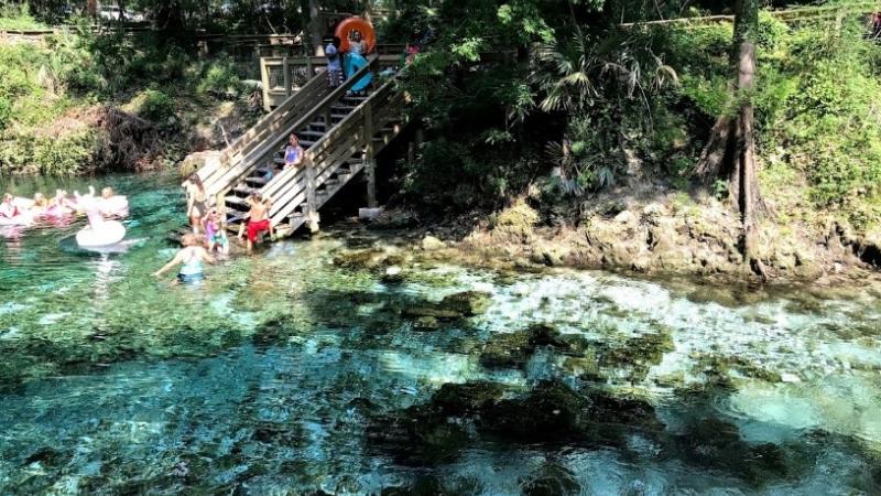
Madison Blue Spring State Park Launch @ FL-6
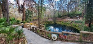
CATEGORIES: Landing
LAYER: Brochure
OWNERSHIP: Public, SRWMD
ACCESS: Yes, Stairs: Wooden steps, PARKING: Free, PICNIC AREA
WATER BODY: Withlacoochee River
Lowest boatable: 40.1′
Highest safe: 50′
GAUGE: Madison
MILE: 11.97
ADDRESS: 8300 FL-6, Lee, FL 32059, Madison County.
DESCRIPTION: The first and only first-magnitude spring on the Withlacoochee River, or the Withlacoochee (north) River as it is sometimes known in Florida. The spring is an easy paddle in from the river. Takeout from the spring is by steep stairs and a long boardwalk. There is a parking fee, because this is a state park, Madison Blue Spring State Park. From Madison, Madison County, FL, travel east on SR 6 to the Withlacoochee River and Madison Blue Springs State Park is on the right. There’s almost always enough water in the river to paddle, but the park may be closed at very high water. Downstream it’s only 1.99 miles or about an hour paddle to Madison Boat Ramp, which is a much better takeout.
WEBSITE: https://www.floridastateparks.org/index.php/parks-and-trails/madison-blue-spring-state-park
ADDITIONAL INFO SOURCES: https://www.theswimguide.org/beach/9634
UPSTREAM: 1.67 miles from Madison Blue Spring State Park Launch to Florida Campsites Ramp
DOWNSTREAM: 1.99 miles from Madison Blue Spring State Park Launch to Madison Boat Ramp
PHOTO: https://wwals.net/pictures/2019-12-16–wq-testing-fl-campsites-us84/20191216_140645.jpg
PHOTOSET: https://wwals.net/pictures/2019-12-16–wq-testing-fl-campsites-us84/
PHOTO SOURCE: John S. Quarterman
PHONE NUMBER: (229) 242-0102
Photoset2: https://www.floridastateparks.org/park/Madison-Blue-Spring
PHOTO2 SOURCE: Florida State Parks
Suggestions: https://forms.gle/DipPgU2TP5atc2Rf9
Madison Boat Ramp @ NE River Park Rd
CATEGORIES: Landing
LAYER: Brochure
OWNERSHIP: Public, Madison County
ACCESS: Yes, Ramp: Concrete, PARKING: Free, PICNIC AREA
WATER BODY: Withlacoochee River
Lowest boatable: 40.1′
Highest safe: 50′
GAUGE: Madison
MILE: 9.98
ADDRESS: 1307 NE River Park Rd, Lee, FL 32059, Madison County.
DESCRIPTION: Madison Boat Ramp is a nice concrete ramp, and a much better kayak or canoe takeout than the stairs at Madison Blue Spring Launch. From the city of Madison in Madison County, FL, travel east on SR 6 to Old Blue Springs Road; turn right, travel east to NE Ivy Drive; turn left and travel east to NE Juniper Drive; turn right and follow to NE River Park Road; turn left and travel east; cross over NE Timber River Loop and into county park.
AKA: Madison Ramp or Withlacoochee Ramp (SRWMD) or Lee Boat Ramp or Water Plant Ramp.
WEBSITE: http://www.dep.state.fl.us/gwt/guide/designated_paddle/withn_guide.pdf
ADDITIONAL INFO SOURCES: https://www.theswimguide.org/beach/9635
UPSTREAM: 1.99 miles from Madison Boat Ramp to Madison Blue Spring State Park Launch
DOWNSTREAM: 1.73 miles from Madison Boat Ramp to Allen Ramp
PHOTO: https://wwals.net/wp-content/themes/pianoblack/img//2015/07/image9.jpg
PHOTO SOURCE: Chris Mericle
PHONE NUMBER: (850) 290-2350
Suggestions: https://forms.gle/DipPgU2TP5atc2Rf9
Allen Ramp @ SW 64th Way
CATEGORIES: Landing
LAYER: Brochure
OWNERSHIP: Public, Hamilton County
ACCESS: Yes, Ramp: Concrete on dirt access road, PARKING: Free, PICNIC AREA
WATER BODY: Withlacoochee River
Lowest boatable: 40.1′
Highest safe: 50′
GAUGE: Madison
MILE: 8.25
ADDRESS: 2726 SW 64th Way Jasper, FL 32052, Hamilton County.
DESCRIPTION: This concrete ramp on a dirt road is a great put-in for springs, including Powerline, Fairy, and second magnitude Suwannacoochee Spring. There are several shoals, Battery, Wipe-out, Deer, and the notorious Melvin Shoals. From Jasper, travel north on US 41 to SR 6; turn left; travel south on SW CR 141 to SW CR 143; turn right and follow SW CR 143 to SW 64 Way and follow to ramp. After the bridge on CR 141, it’s only a couple more miles to the Suwannee River, and then a short paddle upstream to Suwannee River State Park, for 8.47 river miles in all. Don’t forget to picnic on one of the white sand beaches along the way.
AKA: CR 143 ramp (SRWMD) or Hamilton County Road 143 Boat Ramp (Natural Atlas) or Broke Boat Ramp (people with boat trailers).
WEBSITE: https://www.mysuwanneeriver.com/documentcenter/home/view/31
OTHER REFERENCE: https://naturalatlas.com/boat-launches/hamilton-county-road-143-2090335
ADDITIONAL INFO SOURCES: https://www.theswimguide.org/beach/9953
UPSTREAM: 1.73 miles from Allen Ramp to Madison Boat Ramp
DOWNSTREAM: 11.37 miles from Allen Ramp to Anderson Spring Launch
PHOTO: https://wwals.net/pictures/gretchen/2019-06-01–wwals-withlacoochee/P6010772.jpg
PHOTOSET: https://wwals.net/pictures/gretchen/2019-06-01–wwals-withlacoochee/
PHOTO SOURCE: Gretchen Quarterman
PHONE NUMBER: (850) 290-2350
Suggestions: https://forms.gle/DipPgU2TP5atc2Rf9
Anderson Spring Launch
CATEGORIES: Landing
LAYER: Brochure
GPS: 30.352967, -83.18937
OWNERSHIP: Public
ACCESS: Yes, Launch: riverbank
WATER BODY: Suwannee River
GAUGE: Ellaville
MILE: 124.67
ADDRESS: From Live Oak, go west on US 90; turn left onto River Road; entrance to Anderson Springs will be on your right. Suwannee County.
Suggestions: https://forms.gle/DipPgU2TP5atc2Rf9
Pingback: Sasser landing to Jennings Bluff, WWALS Outing 2015-06-14 - WWALS Watershed Coalition
Pingback: Sullivan Launch to Blue Spring, Withlacoochee River Outing 2015-10-24 - WWALS Watershed Coalition
Pingback: Update: Sabal Trail Pipeline, Alapaha, Suwannee, and Withlacoochee Rivers, WWALS Outing 2015-08-15 - WWALS Watershed Coalition
Pingback: Withlacoochee River at US 84 - WWALS Watershed Coalition
Pingback: Withlacoochee River and Sabal Trail @ US 84 -WWALS Field Trip 2015-08-28 - WWALS Watershed Coalition
Pingback: Pictures: Withlacoochee River and Sabal Trail @ US 84 2015-08-28 | WWALS Watershed Coalition
Pingback: Withlacoochee River upstream, Langdale Park to US 41, kayaktivism against Sabal Trail pipeline 2015-10-03 | WWALS Watershed Coalition
Pingback: Pictures: Sullivan Launch to Madison Blue Spring Withlacoochee River 2015-10-24 | WWALS Watershed Coalition
Pingback: Little River Paddle, GA 122 to Lawson Millpond Road 2016-01-16 | WWALS Watershed Coalition
Pingback: Staten Road Bridge, Withlacoochee River | WWALS Watershed Coalition
Pingback: Staten Road bridge to Langdale Park, Withlacoochee River through Valdosta 2016-03-20 | WWALS Watershed Coalition
Pingback: Winners, student logo contest, Withlacoochee and Little River Water Trail, by WWALS | WWALS Watershed Coalition
Pingback: Fourth Annual BIG Little River Paddle Race 2016-05-21 | WWALS Watershed Coalition
Pingback: Little River at GA 37 | WWALS Watershed Coalition
Pingback: Florida Campsites Ramp to SRSP, Withlacoochee River Paddle 2016-06-04 | WWALS Watershed Coalition
Pingback: Fixed: Access to GA 133 Little River Boat Ramp | WWALS Watershed Coalition
Pingback: Nankin to Madison Highway, Withlacoochee River, 2016-07-09 | WWALS Watershed Coalition
Pingback: Ribbon Cutting, new WWTP and Force Main 2016-07-12 | WWALS Watershed Coalition
Pingback: Mozell Spells, Horn Bridge, GA-FL line, Withlacoochee River 2016-10-22 | WWALS Watershed Coalition
Pingback: Withlacoochee River with water @ GA 122, 2016-09-07 | WWALS Watershed Coalition
Pingback: Cook County Landing (GA 76) to Folsom Bridge (GA 122), Little River 2016-01-14 | WWALS Watershed Coalition
Pingback: Suwannee Campsites to State Park 2016-01-14 | WWALS Watershed Coalition (Suwannee RIVERKEEPER®)
Pingback: 5th Annual BIG Little River Paddle Race with grilling and silent auction 2017-04-29 | WWALS Watershed Coalition (Suwannee RIVERKEEPER®)
Pingback: GA 122 @ Withlacoochee River 2017-05-17 | WWALS Watershed Coalition (Suwannee RIVERKEEPER®)
Pingback: Nankin Landing to Madison Highway: Withlacoochee River 2017-10-14 | WWALS Watershed Coalition (Suwannee RIVERKEEPER®)
Pingback: Juneteenth at Reed Bingham State Park, Little River, Reed Bingham State Park East Boat Ramp, 2021-06-19 | WWALS Watershed Coalition (Suwannee RIVERKEEPER®)
Pingback: Nankin to State Line, Withlacoochee River, 2021-08-07 | WWALS Watershed Coalition (Suwannee RIVERKEEPER®)
Pingback: Nankin to State Line and Sullivan Launch, Withlacoochee River, 2021-08-07 | WWALS Watershed Coalition (WWALS) is Suwannee RIVERKEEPER®
Pingback: Two Withlacoochee River 360-degree transits by WWALS on Earthviews 2021-08-16 | WWALS Watershed Coalition (WWALS) is Suwannee RIVERKEEPER®
Pingback: Graco Way illicit dump site, Madison County, Florida 2021-09-04 | WWALS Watershed Coalition (WWALS) is Suwannee RIVERKEEPER®
Pingback: Chairman and Mayor’s Paddle: Troupville to Spook Bridge, Withlacoochee River, 2022-01-29 | WWALS Watershed Coalition (WWALS) is Suwannee RIVERKEEPER®
Pingback: Valdosta-Lowndes County Comprehensive Parks & Recreation Master Plan 2021-08-31 | WWALS Watershed Coalition (WWALS) is Suwannee RIVERKEEPER®
Pingback: Pictures: Sullivan Launch to Madison Blue Spring Withlacoochee River 2015-10-24 | WWALS Watershed Coalition (WWALS) is Suwannee RIVERKEEPER®
Pingback: Chitty Bend East Distributary, Withlacoochee River –Shirley Kokidko 2022-01-07 | WWALS Watershed Coalition (WWALS) is Suwannee RIVERKEEPER®
Pingback: Blue Sink, Sullivan Slough –Susan Liden 2021-01-18 | WWALS Watershed Coalition (WWALS) is Suwannee RIVERKEEPER®
Pingback: Sullivan Slough and Blue Sink by Amanda Davis 2022-01-18 | WWALS Watershed Coalition (WWALS) is Suwannee RIVERKEEPER®
Pingback: Langdale Park, Sugar Creek, Troupville Boat Ramp, Withlacoochee River, Withlacoochee River, Langdale Park Boat Ramp, 2022-05-07 | WWALS Watershed Coalition (WWALS) is Suwannee RIVERKEEPER®
Pingback: Trash beyond fence not finished at Flying J, I-75 exit 2 2022-02-26 | WWALS Watershed Coalition (WWALS) is Suwannee RIVERKEEPER®
Pingback: Withlacoochee Florida Paddle and Cleanup 2022-06-04 | WWALS Watershed Coalition (WWALS) is Suwannee RIVERKEEPER®
Pingback: Earth Day 2022 | WWALS Watershed Coalition (WWALS) is Suwannee RIVERKEEPER®
Pingback: Ideas for short paddles | WWALS Watershed Coalition (WWALS) is Suwannee RIVERKEEPER®
Pingback: Florida Campsites to Allen Ramp, Withlacoochee River 2022-06-04 | WWALS Watershed Coalition (WWALS) is Suwannee RIVERKEEPER®
Pingback: Chainsaw cleanup, Troupville Boat Ramp to Withlacoochee River 2022-06-25 | WWALS Watershed Coalition (WWALS) is Suwannee RIVERKEEPER®
Pingback: Chainsaw Cleanup Returns, Withlacoochee River, Valdosta, 2022-07-30 | WWALS Watershed Coalition (WWALS) is Suwannee RIVERKEEPER®
Pingback: Ken Sulak bridge expedition, Sullivan Launch 2022-08-14 | WWALS Watershed Coalition (WWALS) is Suwannee RIVERKEEPER®
Pingback: Clean rivers 2022-10-06 | WWALS Watershed Coalition (WWALS) is Suwannee RIVERKEEPER®
Pingback: Pictures: Chainsaw Cleanup Withlacoochee River 2022-10-16 | WWALS Watershed Coalition (WWALS) is Suwannee RIVERKEEPER®
Pingback: Franklinville, Skipper Bridge, Langdale Park, GA 133, Withlacoochee River WQ 2022-10-27 | WWALS Watershed Coalition (WWALS) is Suwannee RIVERKEEPER®
Pingback: WWALS at Hahira Veterans Day Parade 2022-11-11 | WWALS Watershed Coalition (WWALS) is Suwannee RIVERKEEPER®
Pingback: Pictures: Hahira Veterans Day Parade 2022-11-11 | WWALS Watershed Coalition (WWALS) is Suwannee RIVERKEEPER®
Pingback: Allen Ramp to SRSP, Withlacoochee River, 2023-02-04 | WWALS Watershed Coalition (WWALS) is Suwannee RIVERKEEPER®
Pingback: Trashjam cleanup, Knights Ferry to Nankin, Withlacoochee River 2022-12-03 | WWALS Watershed Coalition (WWALS) is Suwannee RIVERKEEPER®
Pingback: How far from one Boat Ramp to the next landing? WWALS Water Trails | WWALS Watershed Coalition (WWALS) is Suwannee RIVERKEEPER®
Pingback: Another Cleanup Knights Ferry to Nankin, Withlacoochee River, Knights Ferry Boat Ramp, 2022-12-17 | WWALS Watershed Coalition (WWALS) is Suwannee RIVERKEEPER®
Pingback: Withlacoochee River bridges, Brooks and Lowndes Counties, 1906 and | WWALS Watershed Coalition (WWALS) is Suwannee RIVERKEEPER®
Pingback: Withlacoochee River bridges, Brooks and Lowndes Counties, 1906 and 1917 | WWALS Watershed Coalition (WWALS) is Suwannee RIVERKEEPER®
Pingback: An hour later: Allen Ramp to SRSP, Withlacoochee River 2023-02-02 | WWALS Watershed Coalition (WWALS) is Suwannee RIVERKEEPER®
Pingback: New week river water quality update 2023-02-06 | WWALS Watershed Coalition (WWALS) is Suwannee RIVERKEEPER®
Pingback: Pictures: Trash at Knights Ferry Boat Ramp, Withlacoochee River 2023-02-09 | WWALS Watershed Coalition (WWALS) is Suwannee RIVERKEEPER®
Pingback: Withlacoochee River Landings on Swim Guide 2020-05-14 | WWALS Watershed Coalition (WWALS) is Suwannee RIVERKEEPER®
Pingback: Sugar Creek to Troupville, Withlacoochee River Cleanup 2023-07-22 | WWALS Watershed Coalition (WWALS) is Suwannee RIVERKEEPER®
Pingback: Chainsaw Cleanup, Withlacoochee River, 2023-06-24 | WWALS Watershed Coalition (WWALS) is Suwannee RIVERKEEPER®
Pingback: Water trail sign fixing, Franklinville Road, Withlacoochee River 2023-06-25 | WWALS Watershed Coalition (WWALS) is Suwannee RIVERKEEPER®
Pingback: Freezer full of meat at Clyattville-Nankin Boat Ramp 2023-07-05 | WWALS Watershed Coalition (WWALS) is Suwannee RIVERKEEPER®
Pingback: Withlacoochee Springs and Slough, Sullivan Launch 2023-07-15 | WWALS Watershed Coalition (WWALS) is Suwannee RIVERKEEPER®
Pingback: Yes Another Cleanup Knights Ferry to Nankin, Withlacoochee River 2023-08-05 | WWALS Watershed Coalition (WWALS) is Suwannee RIVERKEEPER®
Pingback: Langdale Park to Sugar Creek Chainsaw Cleanup, Withlacoochee River, 2023-09-09 | WWALS Watershed Coalition (WWALS) is Suwannee RIVERKEEPER®