
“The initial project location is the farthest that mining activity would be from the Okefenokee National Wildlife Refuge (NWR) boundary and the Okefenokee Swamp. Any additional mining that occurs within the 12,000-acre permit area would be closer to the refuge. The northwest boundary of the permit area is within a half mile from the refuge boundary and 400 feet from the edge of the Okefenokee Swamp,” wrote the Fish and Wildlife Service to Senator David Purdue.
You can still comment to the Army Corps demanding an Environmental Impact Statement.
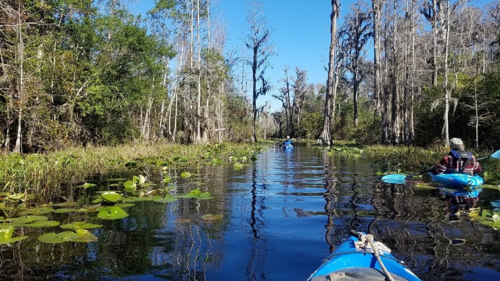
Photo: John S. Quarterman, Okefenokee Swamp, 2017-12-10
The U.S. Fish and Wildlife Service (FWS) wrote that in response to an inquiry by Senator David Perdue of Georgia. Sen. Perdue also asked if FWS actually had jurisdiction over the proposed mining area, and FWS replied saying that it did have several kinds of oversight.
But FWS spelled out the bottom line: “It is the responsibility of the permit applicant to demonstrate what the extent of impacts of the project will be to surrounding natural resources.”
And the applicant still has not done that, not even in its second application.
No longer discussing the northern reaches of its landholdings much doesn’t mean the mining company won’t move on up there over years if they get a toehold.
![[Trail Ridge Land LLC]](https://www.wwals.net/pictures/2019-07-12--tpm-usace/trail-ridge-land.jpg)
Trail Ridge Land LLC
Land the Charlton County Tax Assessors show owned by Trail Ridge Land LLC.
The northwest corner buts right up against the Swamp.
TPM apparently has an agreement with TIAA, the landowner to its west,
so the subject area is also pretty close to the Swamp on its south end.
Please comment to the Corps
You can still send a comment by May 28, 2020, to USACE:
To: CESAS-SpecialProjects@usace.army.mil
Re: Applicant: Twin Pines Minerals, LLC, Application Number: SAS-2018-00554
Be sure to ask for an Environmental Impact Statement.
Or use the convenient comment form in this Action Alert by Waterkeeper Alliance.
You can also mark yourself going in this facebook event to encourage others to comment. But remember to actually send your comment to the Corps.
Why an Environmental Impact Statement
In a letter to Col. Hibner of the U.S. Army Corps of Engineers (USACE), on October 8, 2019, FWS noted:
![[400 ft from the edge of Okefenokee Swamp]](https://www.wwals.net/pictures/2019-11-21--fws-sen-perdue-tpm/Attachment_USFWS-Letter-to-Colonel-Daniel-Hibner-0001.jpg)
400 ft from the edge of Okefenokee Swamp
The Council on Environmental Quality Regulations for Implementing the Procedural Provisions of NEPA (40 CFR 1500 — 1508) Section 1502.3 ‘Statutory requirements for statements’ includes the following: “As required by 102(2)(C) of NEPA environmental impact statements are to be included in every recommendation or report on proposals for legislation and other major federal actions significantly affecting the quality of the human environment (italics added).”
Much of the rest of that letter goes on to examine “significantly” as including “context” and “intensity,” and setting a precedent for future mining on or near Trail Ridge. The context alone should be enough to prevent this mine:
As you are aware, “context” refers to scope of the proposed action, i.e. nationally, regionally, or locally. With this in mind, the future of the Okefenokee Swamp, surrounding landscape and the species that depend on them are directly tied to maintaining the integrity of the ecosystem’s complex ecological processes. The Okefenokee Swamp represents one of the very few self- contained, naturally functioning wetlands in the world. Recognizing the need for federal protection, the majority of the Okefenokee Swamp was set aside as a National Wildlife Refuge (Refuge) in 1937 by Executive Order. The Refuge, currently 406,650 acres in size, was designated a National Natural Landmark in 1974 and a Wetland of International Importance by the Wetlands Convention in 1986. The Okefenokee Wilderness Act of 1974 designated the majority of the Refuge as a National Wilderness Area. The Okefenokee Swamp has shaped the culture of southeast Georgia. Most local residents have ancestors who once lived or worked in the swamp as a part of their heritage.
Dinkins Road, Half Moon, & Bluff Lake Canoe Shelter
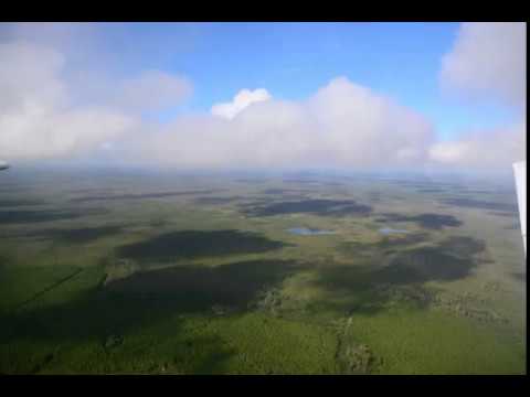
Around Okefenokee Swamp, pictures by Wayne Morgan for WWALS 2019-10-05
On Southwings flight for Suwannee Riverkeeper, pilot Allen Nodorft.Today, the Refuge receives more than 600,000 visits annually. Visitors come from all 50 states, Puerto Rico and more than 46 countries. Ten percent are international visitors. The 2017 Banking on Nature Report (Caudill and Carver 2019) identifies the total recreational expenditures for the four counties surrounding the refuge to be $64.7 million with non-residents accounting for $59.8 million. This was associated with the creation of about 753 jobs, $17.2 million in employment income generated, and $5.4 million in total tax revenue for the counties. The future of people and communities surrounding the swamp is dependent on conserving this popular natural landmark.

Suwannee Canal Road and Boat Ramp
Around Okefenokee Swamp, pictures by Wayne Morgan for WWALS 2019-10-05
On Southwings flight for Suwannee Riverkeeper, pilot Allen Nodorft.“Intensity” refers to the severity of the impact and has a number of considerations. The regulation identifies several items in section 1508.27(b), including:
Item 3; the unique characteristics of the area. The swamp is of national importance as described above and is the largest National Wildlife Refuge and the third largest nationally designated Wilderness area east of the Mississippi River.
There’s more. You can read it for yourself.
![[Distant 2019-11-23]](https://www.wwals.net/pictures/2019-11-23--drone-tpm/74335863_496999617569694_628442505263710208_n.jpg)
TPM equipment on site, with Okefenokee Swamp on northwest horizon,
in anonymous drone aerials,
2019-11-23
Fire and water
If calling Trail Ridge a dam is good enough for FWS, it’s good enough for everybody else:
Trail Ridge forms a rim or geomorphological “dam” on the east side of the swamp contributing to the hydrologic budget of the swamp. The soil of Trail Ridge has a profile or distinct layers. This gives it water holding and water movement characteristics. The mining is proposed to go an average of 50 feet deep from the ground surface which is below the level of the Okefenokee Swamp depression. After heavy mineral removal the soil will be returned to the site. It will have been homogenized or mixed, and no longer have the same distinct layers it had before mining. This will likely change the hydrological properties both temporally and spatially of the entire area. There is much uncertainty as to how dramatic and far reaching this change will be. Similarly, it is uncertain what effects such hydrologic changes may have on the environment.
![[Heavy Mineral Mining In The Atlantic Coastal Plain-0006]](https://www.wwals.net/pictures/2019-09-12--wwals-usace-tpm/Heavy-Mineral_Mining_in_the_Atlantic_Coastal_Plain-0006.jpg)
Heavy Mineral Mining In The Atlantic Coastal Plain-0006
FWS points out that alteration in water flow or levels could make fire more likely, and could adversely affect wildlife (not to mention humans, given that Okefenokee Swamp fire smoke has drifted as far west as Quitman, Georgia, as far north as North Carolina, and farther south than Jacksonville, Florida):
Based on information provided in the JPN and other information currently available to the Service, there appears to be great uncertainty regarding the extent to which alteration of hydrologic processes that sustain the ecosystem may occur.
The range of possible impacts includes moderate to intermittent alteration of hydrologic processes which could indirectly result in seasonally lowered water tables. Lowered water tables within the Okefenokee basin could elevate fire frequency and intensity and alter fire behavior due to increased exposure of traditionally wetted areas. Further, even slight changes in the low mean water table or altered seasonal hydrology could result in a reduction of organic peat soils that dominate the basin. Slight changes in soils, hydrology, and fire behavior would result in changed vegetative patterning that govern habitat conditions. Ultimately, these environmental factors (fire, soils, vegetation) and associated habitat conditions define the ecological and recreational value of the National Wildlife Refuge. To date, data and model results are continuing to be collected and evaluated, therefore, the most likely direct and indirect impacts of the proposed project have yet to be determined.

NASA, Fire and Smoke, 26 April 2017, West Mims Fire on Florida/Georgia Border
See West Mims Fire completely out; update tomorrow 2017-08-07.Several state and federally-listed and federal candidate species may be present or occasionally utilize habitat within the proposed mine footprint. It is unknown how long the effects of the mining will affect these species and the habitats that are currently on and near the site. The effects to the habitat may be permanent and thereby eliminating the species from the local landscape. Also, based on currently available science, it is unknown if the water level and holding capacity of the Okefenokee Swamp will be altered and what impacts this might have on the swamp and surrounding natural features, such as the St. Marys River.
Because of the uncertainty of impacts the Service cannot definitively say that the mining proposal will significantly affect the environment. However, we have concerns that the proposed project could pose substantial risks for adverse impacts to OKENWR and the surrounding environment that may be irreversible even with mitigation.
The Okefenokee Swamp is the headwaters of both the Suwannee and St. Marys Rivers, and any change to the water level or water quality of the Swamp would affect both rivers. So the risk of adverse effects goes far beyond the Swamp, in both Georgia and Florida.
Precedent and past
Plus if this mine is permitted, that could open the slippery slime slope for more mines.
- Item 6; establish a precedent. Though USACE will be primarily considering the impacts of the proposed action from the standpoint of wetlands impacts and compliance with the Clean Water Act; overall, considering the entirety of the project footprint (uplands included), the mine footprint and timeframe are large and impactful. Future mining projects in adjacent portions of Trail Ridge, where there has been mineral interests in the past, could further magnify any environmental impacts by impacting the whole eastern side of the swamp that is adjacent to the sand ridge known as Trail Ridge.
FWS elaborated in its response to Sen. Perdue:
Question 9: Similarly, how close was the proposed DuPont mining project to the Okefenokee Swamp in comparison to the Twin Pines proposed project?
Response: The DuPont mining project extended from Sawfly Road to the south boundary of Toledo Manufacturing’s land, almost the entire eastern edge of the Okefenokee Swamp. The proposed site was directly adjacent to the swamp and parts of the refuge boundary. It was a comparable distance from the swamp as the Twin Pines proposed Alternative 2 site, which is part of the 12,000-acre permit area that is eventually planned to be mined.
That Alternative 2 apparently would be the bit within 400 feet of the Swamp.
On the Heavy Mineral Mining map above, the DuPont project covered the Folkston West Tract and the Toledo Tract. The Twin Pines project is in and around the Saunders Tract.
Below is TPM’s own map of its Alternative 2.
![[Site Locations & Topographic Map]](https://www.wwals.net/pictures/2019-07-12--tpm-usace/SAS-2018-00554-Charlton-0712-SP-HAR-0005.jpg)
Site Locations & Topographic Map
Chemours Mission Mine
Sen. Perdue asked about the Chemours Mission Mine, north of Folkston, in the Satilla River watershed, and FWS answered:
Question 8: It was our office’s understanding that Chemours (formerly Southern Ionics) has been mining in the same general vicinity for many years. Has the Chemours project had a significant impact on any fish or wildlife in the area?
Response: To date, no federally listed species are known to have been impacted by Chemours mining activities. However, based on a recent report and in coordination with Georgia Department of Natural Resources, 1,332 gopher tortoise burrows have been impacted by mining activities. During the mining period, 336 gopher tortoises have been captured and relocated to nearby conservation areas. To date, no eastern indigo snakes have been captured and translocated.
For additional context, Chemours Southern Ionics Mission Site is located on the sand ridge to the east of Trail Ridge known as the Penholoway Shoreline. The area available to mine is small compared to Trail Ridge, and they are only taking minerals from the top 25 feet of soil. The Mission Site is adjacent to a wetland and the Satilla River. These components of the Mission Site are notably different than what is being proposed by Twin Pines (e.g., mining an average of 50 feet deep on Trail Ridge, going to elevations below the basin topography of the Okefenokee Swamp).
So the Chemours Mission Mine and TPM’s proposed Saunders Tract mine are not comparable.
![[Mine to Gulf and Ocean]](https://www.wwals.net/pictures/2020-04-13--usace-tpm-extension-meeting/map-mine-to-seas.jpg)
Mine to Gulf and Ocean in the WWALS
map of all public landings and boat ramps in the Suwannee River Basin.
Chemours Mission Mine is towards the upper right.
The TPM site is circled in red.
The FOIA response documents
Apparently my FOIA request of November 18, 2019, was a few days before FWS responded to Sen. Perdue. Six months later, May 19, 2020, I got these documents as a FOIA response.
- FWS response to John S. Quarterman
- Sen. Perdue request to Department of the Interior
- FWS request to answer Sen. Perdue
- FWS letter to USACE Col. Hibner attached to Sen. Perdue request
- Sen. Perdue questions to U.S. Dept. Interior
- Email_response-to-Perdue_Twin-Pines-Mining-Project.pdf
- Attachment_Final-FWS-Response-to-Perdue_Twin-Pines-Mining-Project.pdf
For far more information about this bad strip-mining proposal, see:
https://wwals.net/issues/titanium-mining/
-jsq, John S. Quarterman, Suwannee RIVERKEEPER®
You can join this fun and work by becoming a WWALS member today!
Short Link: