Tag Archives: portage

Langdale Park to Sugar Creek Chainsaw Cleanup, Withlacoochee River, 2023-09-09

Come help us remove some deadfalls that are impeding canoe and kayak paddling.

Bring a chainsaw if you really know how to use it.

But you do not have to use a saw to join us.

When: Gather 9 AM, launch 9:30 AM, end 1 PM, Saturday, September 9, 2023

Put In: Langdale Park Boat Ramp, 3781 N. Valdosta Rd., Valdosta, GA 31602,

GPS: 30.88747, -83.32395

[Easy and hard deadfalls 2021-05-15]
Easy and hard deadfalls, 2021-05-15

Continue reading

Pictures: Nice day for a portage around Big Shoals, Suwannee River 2021-05-19

Four is enough for a fun Suwannee River paddle and portage around Big Shoals. Thanks to Bobby McKenzie for leading us.

[Put In, Portage, Big Shoals, Bell Springs Run, Little Shoals, US 41]
Put In, Portage, Big Shoals, Bell Springs Run, Little Shoals, US 41

There are many more pictures on the WWALS website, with copies on facebook.

Dennis Price will lead us through the same stretch on Continue reading

Big Shoals Scouting, Suwannee River 2021-05-14

Bring boat wheels and be ready for a half-mile portage around Big Shoals in the WWALS outing tomorrow.

[Portage Now, Big Shoals, Beach eddy, Banner at beach below shoals]
Portage Now, Big Shoals, Beach eddy, Banner at beach below shoals

That’s the conclusion from the Friday scouting organized by Park Manager Manny Perez and Randy Madison of Florida Trails, in conjunction with WWALS Intern Bobby McKenzie and Suwannee Riverkeeper John S. Quarterman. Park Ranger Peter Shanks led Randy, Bobby, and me to three possible put-ins below BIG Shoals. The third one is best, with a nice slope to a beach.

We are all for reasonable accommodation per our WWALS nondiscrimination policy, which in this case means you’ll need to be able to climb up at the take-out before the shoals, pull your boat for a half mile, including dragging it over a couple of rough spots, and slide it back into the water at the beach put-in. We can help, but you’ll need to do most of the work, because we’ll be pulling our own boats.

Click on any of the small pictures below to see a bigger one. There’s also a google map of the locations of these pictures. Continue reading

Big Shoals, Suwannee River, Florida, 2021-05-19

Update 2022-09-08: Nice day for a portage around Big Shoals, Suwannee River 2021-05-19.

Update 2021-05-18: It’s a half mile portage, so bring boat wheels and be prepared to haul over some rough spots down to the beach of the two gators.

Paddle to and portage past the biggest rapids in Florida: Big Shoals and Little Shoals on the Suwannee River, on this short weekday trip.

[Big Shoals, 20 and 21 Feb 2021, Map]
Big Shoals, 20 and 21 Feb 2021, Map

When: Gather 9 AM, launch 10 AM, end 2 PM, Wednesday, May 19, 2021

Put In: Big Shoals Tract Launch.
From White Springs, travel north on CR 135 to SE 94 Street (Godwin Bridge Road); turn right and follow road to Big Shoals, in Hamilton County.

GPS: 30.353167, -82.687333

Portage: The portage is 400 feet long.
Participants must be able to carry everything they bring from the beginning of the portage to the re-launch. Also must have fairly good physical conditioning and balance to climb up and down banks to re-launch.

Shirley Kokidko, experienced with this section of the Suwannee, says, “I’m 65 and I can do it, but it’s not easy, and takes a good bit of teamwork to get everybody re-launched. No children. Let’s keep this group to a safe number. On a weekday that probably won’t be a problem.”

Everyone must have a bowline, rope of any sort, very much needed to help lower boats back into the water after the portage. Continue reading

Cypress Creek South (CR 6) to Cone Bridge, Suwannee River, 2019-05-04

Rescheduled due to low water. Now we’re starting at Cypress Creek Launch on CR 6, and paddling to Cone Bridge Ramp.

A quiet, tranquil 9.4 mile section of the Suwannee River on a paddle appropriate for paddlers of any level.

When: Gather 9:00 AM, Launch 9:30 AM, Saturday, May 4, 2019

Put In: Cypress Creek South Launch @ CR 6. From White Springs, Travel north on CR 135 to SR 6, turn right; travel east to the bridge. At the foot of the bridge, turn left onto road shoulder and follow the road to the river.
From Valdosta, GA, travel south on I-75 to exit 460 for FL-6 toward Jasper, FL; travel east 11.4 miles, turn right to stay on FL 6. Continue through Jasper onto Hatley Street, which becomes CR 6. Continue 14.5 miles to the left turnoff just before the Suwannee River.

GPS: 30.50737, -82.71711

Take Out: Cone Bridge Ramp. From Lake City, travel north on US 441 to NW Cone Bridge Road; turn left and follow road to ramp.

Bring: a rope to drag your boat, the usual personal flotation device, boat paddles, food, drinking water, warm clothes, and first aid kit.

Also trash pickers and trash bags: every WWALS outing is also a cleanup.

Free: This outing is free to WWALS members, and $10 (ten dollars) for non-members. We recommend you support the work of WWALS by becoming a WWALS member today!

Event: facebook, meetup
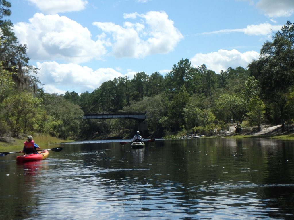
Photo: John S. Quarterman, Cypress Creek South Launch, 2016-09-05
Photo: John S. Quarterman, Cypress Creek South Launch, 2016-09-05.

This paddle is on the Suwannee River Wilderness Trail (SRWT). Continue reading

Cone Bridge, Big Shoals Portage, to Suwannee Wayside Park, Suwannee River, 2019-05-04

Update 2019-04-18: Due to low water, changed to Cypress Creek South (CR 6) to Cone Bridge, Suwannee River, still May 4, 2019.

This 15.6 mile paddle includes a strenuous portage around Big Shoals, the biggest whitewater rapids in Florida and paddling over a smaller set of rapids at Little Shoals. Due to the portage which involves climbing up and down steep, sandy banks with kayaks, carrying kayaks 300 feet and lifting over downed trees, this trip is listed as difficult. You must be physically able to get back into your kayak on the slippery edge of this swift moving section of the Suwannee River. We help each other as much as possible, but ultimately you are responsible for your boat. We will take a break at the shoals and enjoy the outstanding view. No one is paddling over the shoals and this portage is the only way around.

When: Gather 8:30 AM, Launch 10 AM, Thursday, May 4, 2019

Put In: Cone Bridge Ramp, From Lake City, travel north on US 441 to NW Cone Bridge Road; turn left and follow road to ramp in Columbia County.

GPS: 30.445156, -82.670845

Take Out: Suwannee Wayside Ramp, From White Springs, travel south on US 41 to the river; the ramp is on the south side in the town park. Hamilton County.

Bring: a rope to drag your boat, the usual personal flotation device, boat paddles, food, drinking water, warm clothes, and first aid kit.

Also trash pickers and trash bags: every WWALS outing is also a cleanup.

Free: This outing is free to WWALS members, and $10 (ten dollars) for non-members. We recommend you support the work of WWALS by becoming a WWALS member today!

Event: facebook, meetup

Photo: Gretchen Quarterman, Cone Bridge Boat Ramp, 2015-11-22

This paddle is on the Suwannee River Wilderness Trail (SRWT). Continue reading