
Update 2022-08-08: Couple more short paddle ideas: State Line Boat Ramp upstream to Arnold Springs, and Florida Campsites upstream.
Update 2022-05-30: Three more short paddle ideas (on the Withlacoochee River and the Alapahoochee River), along with safety information and links to the WWALS water trails with more information.
We often get questions like this: “The wife and I just got our kayaks and we’re looking for some ideas for short trips.”
Here are some suggestions on lakes, swamps, and rivers in the Suwannee River Basin.
Safety first! Always wear your personal flotation device (PFD). You’d be surprised how hard it is to find your PDF after you fall in. And especially if you’re new to paddling, don’t go alone. You may want to join some of the many WWALS outings. See: https://wwals.net/outings/
Lakes:
Easy paddles with no current, no worries about water levels, and no need for a shuttle: put in and take out at the same spot.
But no matter how easy lakes are to paddle, wear your PFD.
Banks Lake Boat Ramp

307 Georgia 122, Lakeland, GA 31635, in Banks Lake National Wildlife Refuge, a mini-Okefenokee with cypress trees, Spanish moss, often Ospreys, usually bats in the summer, and always alligators.
Site of the monthly WWALS Full Moon paddles to see the sun set and the moon rise.
Reed Bingham State Park Lake
542 Reed Bingham Rd, Adel, GA 31620. $5 park entry fee. This lake has two boat ramps, West in Colquitt County, and East in Cook County.
Plus a swimming beach, where WWALS annually assists new boaters at Juneteenth.
And you can rent an island.

Grassy Pond Boat Ramp

5360 Grassy Pond Dr., Lake Park, GA 31636. A good ramp in a park affiliated with Moody Air Force Base, now open to the public for daily enjoyment.
Also has restrooms, water, snacks, and hiking trails.
See: https://moodyfss.com/grassy-pond/
Rivers:
River paddles typically require a shuttle, as in a way to get your vehicle from your put-in to your take-out. See our list of outfitters for that. Or if you have more than one vehicle, drop your boat off at the put-in, take the rest to the take-out, and drive back to the put-in in one vehicle.
Some suggestions are for paddles upstream and back: those need no shuttle.
For water levels, follow the link for each landing.
On river paddles, really always wear your personal flotation device (PFD). Sweepers (overhanging limbs) can tip you in, deadfalls (fallen trees) or rocks can knock you over, or you can just fall in. You will look much better afterwards if you don’t get stuck under a strainer (a limb in the water) or other entrapment (such as an overhanging bank) and can’t get out. Needless to say, if you’re new, don’t try rapids. Don’t go alone, especially if you’re new to paddling. File a float plan, or at least tell somebody where you are going and when to expect you back. Paddling is fun, but safety first.
You may want to join some of the many WWALS outings. See: https://wwals.net/outings/
Little River
For much more about the Little River, see the Withlacoochee and Little River Water Trail (WLRWT).
Red Roberts Landing, Little River

4727 Rountree Bridge Rd., Adel, GA 31620. River left at Rountree Bridge south of Rountree Bridge Road (CR 251) west of Adel; exit 41 off I-75.
3.64 Little River miles to Reed Bingham State Park West Boat Ramp (or go to the East Ramp). Check the water levels first.
Site of the annual WWALS BIG Little River Paddle Race. Also, there are hiking trails at Red Roberts Landing, and restrooms at the destination.
Withlacoochee River
For much more about the Withlacoochee River, see the Withlacoochee and Little River Water Trail (WLRWT).
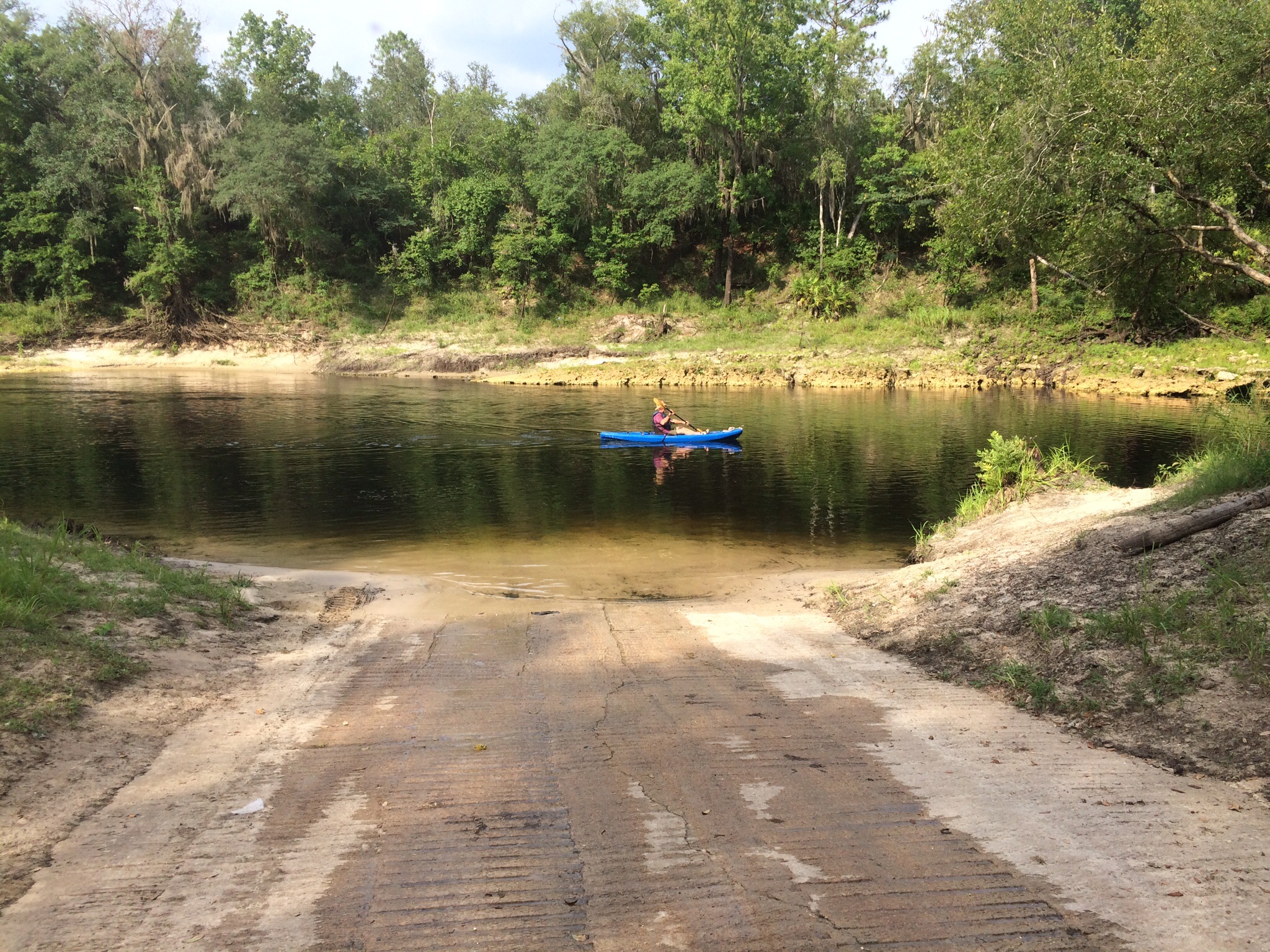
State Line Boat Ramp, Withlacoochee River at GA 33 or CR 145
This is the put-in with five other names: Mozell Spells (local people) or Madison Highway Boat Ramp (VLPRA) or State Line Ramp (GA DNR) or GA 31 Ramp (SRWMD) or CR 145 Bridge Launch (FDEP).
Arnold Springs, 2017-10-14.
A pretty easy paddle is upstream 1.98 miles to Arnold Springs and back. Arnold Springs is actually three little springs on the left bank (your right as you paddle upstream). They add up to a second magnitude spring. There are only two second magnitude springs in the Suwannee River Basin in Georgia, of only six in the entire state. The other one is also on the Withlacoochee River, upstream past several rapids.
Stay in or near the water at Arnold Springs. The surrounding land is private property.
Florida Campsites Ramp, Withlacoochee River at NW 47th Street

2137 NW 47th St, Jasper, FL 32052. From Jasper, Hamilton County, FL, travel north on US 41 to SR 6; turn left; travel west on SR 6 to CR 143; turn right and travel north to NW 44 Street; turn left; follow road to NW 45 Street; turn right; follow road to NW 22 Avenue; turn left and follow road to NW 21 Place and ramp is on the right.
You can paddle upstream to any sandbar you like, and then back down. For example, the first upstream sharp bend in the river has a beach and across the river from the beach has a dried up spring area; thanks to Dallas Bush for reminding us of this one. If you want to see something unusual, paddle 1.78 river miles up to Chitty Bend East Distributary, moor your boat, and walk into that opposite of a tributary, where river water flows in towards some sinkholes.
![[Distributary to River with Hiker --Susan Liden]](https://www.wwals.net/pictures/2021-01-01--withlacoochee-distributary/241780154_411184064089337_5870075784232610791_n.jpg)
Distributary to River with Hiker –Susan Liden
Or paddle downstream 3.66 Withlacoochee River miles to Madison Boat Ramp.
Along the way are some nice swimming beaches, and Madison Blue Spring, the only first-magnitude spring on the Withlacoochee River, and some other springs including Pot Spring.
You can take out at Madison Blue after 1.67 miles. If you do, you will get your exercise hauling your boat up the steps and along the boardwalk.
Madison Boat Ramp, Withlacoochee River at River Park Road
1307 NE River Park Rd, Lee, FL 32059. From the city of Madison in Madison County, FL, travel east on SR 6 to Old Blue Springs Road; turn right, travel east to NE Ivy Drive; turn left and travel east to NE Juniper Drive; turn right and follow to NE River Park Road; turn left and travel east; cross over NE Timber River Loop and into county park.
To Allen Ramp is 1.73 Withlacoochee River miles, with at least two springs.
Alapaha River
For much more about the Alapaha River, see the Alapaha River Water Trail (ARWT).
Hotchkiss Road Landing, Alapaha River

Just east of the Alapaha River on US 84, turn north onto Hotchkiss Road, and follow it to the river.
1.11 Alapaha River miles to Naylor Boat Ramp. Really check the water levels first.
Naylor Boat Ramp, Alapaha River at US 84
6955 US 84 E, Naylor, GA 31641, right bank, west of the river, north of US 84.
You can paddle up 1.11 Alapaha River miles to Hotchkiss Road, lunch there, and paddle back. No shuttle required.
Be sure to check the water levels first: too low, and you’ll be dragging your boat.
Alapahoochee River
For much more about the Alapahoochee River, see the Alapaha River Water Trail (ARWT).
Sasser Landing, Alapaha River @ NW 72nd Court

Left bank, east of river, north of CR 150. From Jennings, Hamilton County, FL, travel east on CR 150; cross the Alapaha River; turn left onto NW 72 Court and follow to river.
Less than 500 feet upstream on the right bank (your left as you paddle upstream) is the Alapahoochee River Confluence. Go up the Alapahoochee River 0.35 miles, and on river right (your left) you will see Turket Creek Waterfall.

The height of the waterfall depends on the level of the river. At low water it can be seven feet high. Lower and you’ll be dragging your boat up there. Too high, and you won’t be able to paddle up the Alapahoochee River.
Suwannee River
For much more about the Suwannee River, see the Suwannee River Wilderness Trail (SRWT).
Suwannee Springs Launch, Suwannee River
![[Sheriff, Suwannee Riverkeeper banner, Gretchen]](https://www.wwals.net/pictures/2020-10-16--suwannee-fl-6-sl/20201016_142847.jpg)
Sheriff, Suwannee Riverkeeper banner, Gretchen. Photo: John S. Quarterman 2020-10-16
3243 91st Dr., Live Oak, FL 32060. From Live Oak, travel north on US 129 to 93 Drive; turn right; travel north to 32 Street; turn right and follow to park area.
1.5 Suwannee River miles to Spirit of the Suwannee Music Park Ramp, where there is an outfitter with shuttles.
And there’s a sulfur spring near the ramp, with an old stone spring wall.
Stephen C. Foster State Park Ramp, Suwannee River, Okefenokee Swamp

17515 GA-177, Fargo, GA 31631. From Fargo, travel south on US 441 to CR 177; turn left and travel to Stephen C. Foster State Park.
Paddle upstream 1.71 Suwannee River Miles to Billys Island Landing, Lunch there, walk around the island and see the scattered remains of the once-thriving logging colony and the earlier settlement. See huge pines on the island, cypress and many birds on the water, plus turtles and alligators.
You can help stop a proposed titanium strip mine far too close to the Okefenokee Swamp.
WWALS Outings
WWALS has at least one river outing or cleanup a month, plus the monthly Banks Lake Full Moon paddles. See: https://wwals.net/outings/
-jsq, John S. Quarterman, Suwannee RIVERKEEPER®
You can join this fun and work by becoming a WWALS member today!
Short Link:
Do you think a kayaker with an 8 ft kayak is safe to paddle at Stephen Foster SP?
I’ve seen people paddle with 8-foot kayaks at SCFSP. Also, you can rent kayaks or canoes right there.