
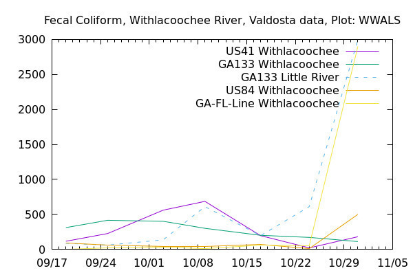
Was there rain Wednesday? That might explain the sudden spikes at US 41 on the Withlacoochee River, at GA 133 on the Little River, and at State Line on the Withlacoochee River. We can guess that the rains Thursday and Friday (today) have washed away whatever that very odd spike was at the state line.
Thanks to Valdosta Utilities and Valdosta City Clerk Teresa Bolden for sending this Wednesday’s Valdosta water quality testing data before the end of Friday. For more contact, see https://wwals.net/issues/vww/.
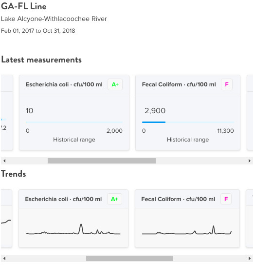
State Line, Withlacoochee River, Withlacoochee Basin
It’s a very odd spike, because it’s only in Fecal coliform, not in E. coli. Whatever it was should have washed away by now.
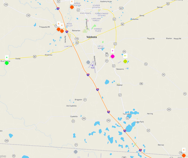
Map of Stations, Stations
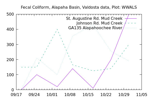
Graph, Alapaha Basin
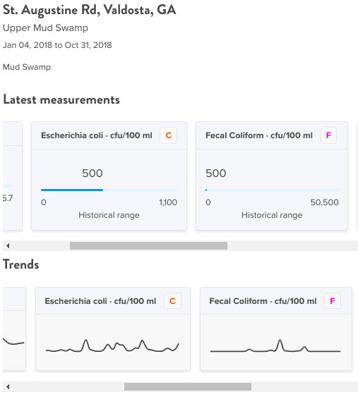
There was also a spike at St. Augustine Road on Mud Creek.
St. Augustine Road, Mud Creek, Alapaha Basin
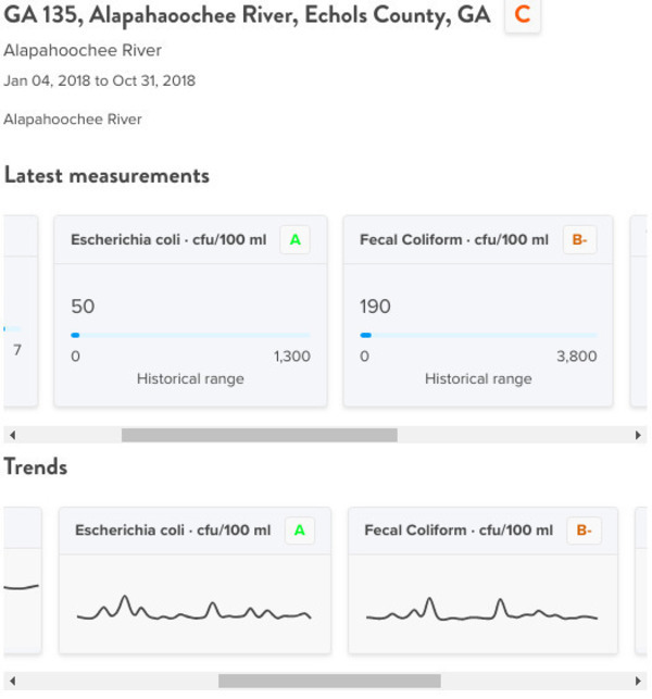
GA 135, Alapahoochee River, Alapaha Basin
Meanwhile, levels downstream at the Alapahoochee River were dropping.
WWALS Water Quality Testing
The WWALS Boomerang paddle race has been a bit distracting for doing WWALS water quality testing, but we’ll get in gear on that after this Saturday. If you want to help, please go ahead and sign up on waterreporter.org and join the Suwannee Riverkeeper group.
-jsq, John S. Quarterman, Suwannee RIVERKEEPER®
You can join this fun and work by becoming a WWALS member today!
Map in Water Reporter
Here is the map of this data in Water Reporter. Click on one of the diamond shapes to see graphs.
Short Link: